Gararu geodata
Gararu (Sergipe) is a populated place; located in Brazil in America/Maceio (GMT-3) time zone. With population of 2,977 people, there are 1992 cities with bigger population in this country. Compared to other cities in Brazil, 67.9% of cities are located further ↓South; 88.6% of cities are located further ←West and 90.4% of cities have higher elevation than Gararu. Note1


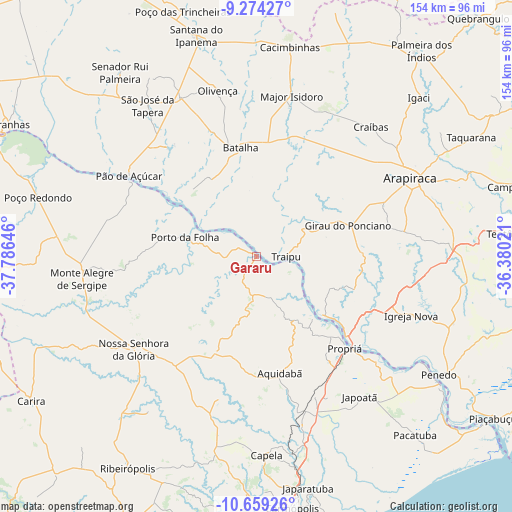
Gararu GPS coordinates[2]
9° 58' 3" South, 37° 4' 59.988" West
| Map corner | latitude | longitude |
|---|---|---|
| Upper-left | -9.27427°, | -37.78646° |
| Center: | -9.9675°, | -37.08333° |
| Lower-right: | -10.65926°, | -36.38021° |
| Map W x H: | 154×154 km | = 95.7×95.7mi |
| max Lat: | 2.81972° ⇑32.1% North |
| Gararu: | -9.9675° |
| min Lat: | ⇓67.9% South -33.69111° |
| min Long | Gararu | max Long |
| -72.89583° | -37.08333° | -32.41083° |
| W 88.6%⇐ | ⇒11.4% E |
Elevation
Elevation of Gararu is 17 m = 56 ft, and this is 363.9 m = 1194 ft below average elevation for this country.
| Max E: |
1603 m = 5259 ft | 90.4% |
| Avg. | 380.9 m = 1250 ft | |
| Gararu | 17 m = 56 ft | |
Min E: |
0 m = 0 ft | 9.6% |
See also: Brazil elevation on elevation.city.
Geographical zone
Gararu is located in South Torrid zone (between Equator and Tropic of Capricorn). Distance of Equator is 1108.3 km =688.7 mi to North.| Distance of | km | miles | from Gararu |
|---|---|---|---|
| Equator | 1108.3 | 688.7 | to North |
| Tropic Capricorn | 1497.6 | 930.6 | to South |
| Antarctic Circle | 6292.9 | 3910.2 | to South |
| South Pole | 8898.8 | 5529.5 | to South |


Nearby cities:
15 places around Gararu: (largest is in red/bold)
• Aquidabã
35.6 km =22.1 mi,  168°
168°
• Arapiraca
52.1 km =32.4 mi,  62°
62°
• Batalha
32.5 km =20.2 mi,  351°
351°
• Girau do Ponciano
29.4 km =18.3 mi,  71°
71°
• Igreja Nova
49.4 km =30.7 mi,  110°
110°
• Japoatã
52.3 km =32.5 mi,  143°
143°
• Lagoa da Canoa
40.8 km =25.4 mi, 67°
• Major Isidoro
49.6 km =30.8 mi,  12°
12°
• Nossa Senhora da Glória
46.2 km =28.7 mi,  232°
232°
• Olivença
51.3 km =31.9 mi, 346°
• Porto Real do Colégio
36 km =22.4 mi,  132°
132°
• Porto da Folha
22.1 km =13.7 mi,  284°
284°
• Propriá
38 km =23.6 mi, 135°
• Pão de Açúcar
45.7 km =28.4 mi,  302°
302°
• Traipu
8.8 km =5.5 mi,  92°
92°
Sources, notices
• [Note1] Compared only with cities in Brazil existing in our database
• [Src1] Map data: © OpenStreetMap contributors (CC-BY-SA)
• [Src2] Other city data from geonames.org with taken over terms of usage.
• [Src3] Geographical zone / Annual Mean Temperature by Robert A. Rohde @ Wikipedia
