Nova Olinda do Norte geodata
Nova Olinda do Norte (Amazonas) is a populated place; located in Brazil in America/Manaus (GMT-4) time zone. With population of 12,343 people, there are 1446 cities with bigger population in this country. Compared to other cities in Brazil, 91.7% of cities are located further ↓South; 97% of cities are located further →East and 87.8% of cities have higher elevation than Nova Olinda do Norte. Note1


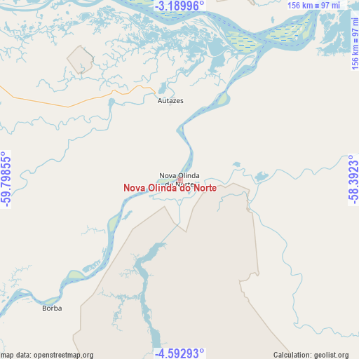
Nova Olinda do Norte GPS coordinates[2]
3° 53' 30.264" South, 59° 5' 43.512" West
| Map corner | latitude | longitude |
|---|---|---|
| Upper-left | -3.18996°, | -59.79855° |
| Center: | -3.89174°, | -59.09542° |
| Lower-right: | -4.59293°, | -58.3923° |
| Map W x H: | 156×156 km | = 96.9×96.9mi |
| max Lat: | 2.81972° ⇑8.3% North |
| Nova Olinda do Norte: | -3.89174° |
| min Lat: | ⇓91.7% South -33.69111° |
| min Long | Nova Olinda do | max Long |
| -72.89583° | -59.09542° | -32.41083° |
| W 3%⇐ | ⇒97% E |
Elevation
Elevation of Nova Olinda do Norte is 22 m = 72 ft, and this is 358.9 m = 1177 ft below average elevation for this country.
| Max E: |
1603 m = 5259 ft | 87.8% |
| Avg. | 380.9 m = 1250 ft | |
| Nova Olinda do Norte | 22 m = 72 ft | |
Min E: |
0 m = 0 ft | 12.2% |
See also: Brazil elevation on elevation.city.
Geographical zone
Nova Olinda do Norte is located in South Torrid zone (between Equator and Tropic of Capricorn). Distance of Equator is 432.7 km =268.9 mi to North.| Distance of | km | miles | from Nova Olinda do Norte |
|---|---|---|---|
| Equator | 432.7 | 268.9 | to North |
| Tropic Capricorn | 2173.2 | 1350.4 | to South |
| Antarctic Circle | 6968.5 | 4330 | to South |
| South Pole | 9574.3 | 5949.2 | to South |


Nearby cities:
15 places around Nova Olinda do Norte: (largest is in red/bold)
• Autazes
34.9 km =21.7 mi,  353°
353°
• Barreirinha
255.9 km =159 mi,  61°
61°
• Borba
78 km =48.5 mi,  224°
224°
• Careiro da Várzea
112 km =69.6 mi,  313°
313°
• Guajará
189 km =117.4 mi, 57°
• Iranduba
138.6 km =86.1 mi,  299°
299°
• Itacoatiara
110.2 km =68.5 mi,  40°
40°
• Manacapuru
181.6 km =112.8 mi,  291°
291°
• Manaquiri
153.2 km =95.2 mi, 294°
• Manaus
135.5 km =84.2 mi, 310°
• Maués
162.9 km =101.2 mi,  69°
69°
• Novo Aripuanã
197.3 km =122.6 mi,  226°
226°
• Rio Preto da Eva
148.8 km =92.5 mi,  333°
333°
• Urucará
211.4 km =131.4 mi, 44°
• Urucurituba
134.2 km =83.4 mi,  50°
50°
Sources, notices
• [Note1] Compared only with cities in Brazil existing in our database
• [Src1] Map data: © OpenStreetMap contributors (CC-BY-SA)
• [Src2] Other city data from geonames.org with taken over terms of usage.
• [Src3] Geographical zone / Annual Mean Temperature by Robert A. Rohde @ Wikipedia
