Jacareacanga geodata
Jacareacanga (Pará) is a populated place; located in Brazil in America/Santarem (GMT-3) time zone. With population of 1,402 people, there are 2014 cities with bigger population in this country. Compared to other cities in Brazil, 84.4% of cities are located further ↓South; 96.7% of cities are located further →East and 75.8% of cities have higher elevation than Jacareacanga. Note1


Jacareacanga GPS coordinates[2]
6° 13' 19.992" South, 57° 45' 10.008" West
| Map corner | latitude | longitude |
|---|---|---|
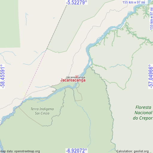
| Upper-left | -5.52279°, | -58.45591° |
| Center: | -6.22222°, | -57.75278° |
| Lower-right: | -6.92072°, | -57.04966° |
| Map W x H: | 155.4×155.4 km | = 96.6×96.6mi |
| max Lat: | 2.81972° ⇑15.6% North |
| Jacareacanga: | -6.22222° |
| min Lat: | ⇓84.4% South -33.69111° |
| min Long | Jacareacanga | max Long |
| -72.89583° | -57.75278° | -32.41083° |
| W 3.3%⇐ | ⇒96.7% E |
Elevation
Elevation of Jacareacanga is 72 m = 236 ft, and this is 308.9 m = 1013 ft below average elevation for this country.
| Max E: |
1603 m = 5259 ft | 75.8% |
| Avg. | 380.9 m = 1250 ft | |
| Jacareacanga | 72 m = 236 ft | |
Min E: |
0 m = 0 ft | 24.2% |
See also: Brazil elevation on elevation.city.
Geographical zone
Jacareacanga is located in South Torrid zone (between Equator and Tropic of Capricorn). Distance of Equator is 691.8 km =429.9 mi to North.| Distance of | km | miles | from Jacareacanga |
|---|---|---|---|
| Equator | 691.8 | 429.9 | to North |
| Tropic Capricorn | 1914.1 | 1189.4 | to South |
| Antarctic Circle | 6709.3 | 4169 | to South |
| South Pole | 9315.2 | 5788.2 | to South |


Nearby cities:
15 places around Jacareacanga: (largest is in red/bold)
• Autazes
331.1 km =205.7 mi,  332°
332°
• Barreirinha
388.7 km =241.5 mi,  11°
11°
• Borba
287.7 km =178.8 mi,  315°
315°
• Careiro da Várzea
407.4 km =253.1 mi, 325°
• Guajará
362.1 km =225 mi,  1°
1°
• Iranduba
423.5 km =263.2 mi, 320°
• Itacoatiara
350.8 km =218 mi,  347°
347°
• Itaituba
291.9 km =181.4 mi,  42°
42°
• Manicoré
395 km =245.4 mi,  276°
276°
• Maués
315.6 km =196.1 mi, 0°
• Nova Olinda do Norte
298.8 km =185.7 mi, 330°
• Novo Aripuanã
315.4 km =196 mi,  292°
292°
• Parintins
415.2 km =258 mi,  15°
15°
• Urucará
409.8 km =254.6 mi,  359°
359°
• Urucurituba
346.9 km =215.6 mi, 352°
Sources, notices
• [Note1] Compared only with cities in Brazil existing in our database
• [Src1] Map data: © OpenStreetMap contributors (CC-BY-SA)
• [Src2] Other city data from geonames.org with taken over terms of usage.
• [Src3] Geographical zone / Annual Mean Temperature by Robert A. Rohde @ Wikipedia
