Октябрьский geodata
Октябрьский (Minsk) is a populated place; located in Belarus in Europe/Minsk (GMT+3) time zone. With population of 2,300 people, there are 181 cities with bigger population in this country. Compared to other cities in Belarus, 71.4% of cities are located further ↓South; 60.5% of cities are located further ←West and 75.3% of cities have lower elevation than Октябрьский. Note1


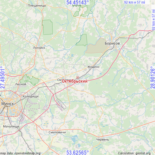
Октябрьский GPS coordinates[2]
54° 2' 26.124" North, 28° 11' 53.268" East
| Map corner | latitude | longitude |
|---|---|---|
| Upper-left | 54.45143°, | 27.49501° |
| Center: | 54.04059°, | 28.19813° |
| Lower-right: | 53.62565°, | 28.90126° |
| Map W x H: | 91.8×91.8 km | = 57×57mi |
| max Lat: | 56.0147° ⇑28.6% North |
| Октябрьский: | 54.04059° |
| min Lat: | ⇓71.4% South 51.75° |
| min Long | Октябрь� | max Long |
| 23.37083° | 28.19813° | 32.578° |
| W 60.5%⇐ | ⇒39.5% E |
Elevation
Elevation of Октябрьский is 185 m = 607 ft, and this is 16.4 m = 54 ft above average elevation for this country.
| Max E: |
309 m = 1014 ft | 24.7% |
| Октябрьский | 185 m 607 ft | |
| Avg. | 168.6 m = 553 ft | |
Min E: |
108 m = 354 ft | 75.3% |
See also: Belarus elevation on elevation.city.
Geographical zone
Октябрьский is located in North temperate zone (between Tropic of Cancer and the Arctic Circle). Distance of this North polar circle is 1392.4 km =865.2 mi to North.| Distance of | km | miles | from Октябрьский |
|---|---|---|---|
| North Pole | 3998.3 | 2484.4 | to North |
| Arctic Circle | 1392.4 | 865.2 | to North |
| Tropic Cancer | 3402.8 | 2114.4 | to South |
| Equator | 6008.8 | 3733.7 | to South |


Nearby cities:
15 places around Октябрьский: (largest is in red/bold)
• Barysaw
28.9 km =18 mi,  43°
43°
• Gorodishche
24.4 km =15.2 mi,  254°
254°
• Horad Smalyavichy
7.3 km =4.5 mi,  256°
256°
• Horad Zhodzina
10.9 km =6.8 mi,  53°
53°
• Kalodzishchy
29.2 km =18.1 mi, 248°
• Korolëv Stan
26.8 km =16.7 mi, 257°
• Lahoysk
29.2 km =18.1 mi,  309°
309°
• Lyeskawka
32.1 km =19.9 mi, 262°
• Slabada
20.7 km =12.9 mi, 260°
• Usiazh
13.1 km =8.1 mi,  287°
287°
• Valyevachy
32.1 km =19.9 mi,  184°
184°
• Yukhnovka
23.3 km =14.5 mi, 251°
• Zabalotstsye
11.8 km =7.3 mi, 250°
• Zamostochye
32.7 km =20.3 mi,  221°
221°
• Zyalyony Bor
19 km =11.8 mi,  99°
99°
Sources, notices
• [Note1] Compared only with cities in Belarus existing in our database
• [Src1] Map data: © OpenStreetMap contributors (CC-BY-SA)
• [Src2] Other city data from geonames.org with taken over terms of usage.
• [Src3] Geographical zone / Annual Mean Temperature by Robert A. Rohde @ Wikipedia
