Machulishchy geodata
Machulishchy (Minsk) is a populated place; located in Belarus in Europe/Minsk (GMT+3) time zone. With population of 8,000 people, there are 103 cities with bigger population in this country. Compared to other cities in Belarus, 52% of cities are located further ↓South; 53.9% of cities are located further →East and 91.1% of cities have lower elevation than Machulishchy. Note1


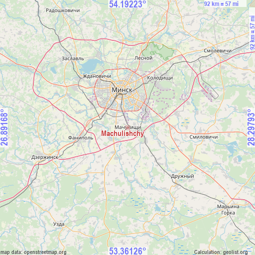
Machulishchy GPS coordinates[2]
53° 46' 43.68" North, 27° 35' 41.28" East
| Map corner | latitude | longitude |
|---|---|---|
| Upper-left | 54.19223°, | 26.89168° |
| Center: | 53.7788°, | 27.5948° |
| Lower-right: | 53.36126°, | 28.29793° |
| Map W x H: | 92.4×92.4 km | = 57.4×57.4mi |
| max Lat: | 56.0147° ⇑48% North |
| Machulishchy: | 53.7788° |
| min Lat: | ⇓52% South 51.75° |
| min Long | Machulishchy | max Long |
| 23.37083° | 27.5948° | 32.578° |
| W 46.1%⇐ | ⇒53.9% E |
Elevation
Elevation of Machulishchy is 215 m = 705 ft, and this is 46.4 m = 152 ft above average elevation for this country.
| Max E: |
309 m = 1014 ft | 8.9% |
| Machulishchy | 215 m 705 ft | |
| Avg. | 168.6 m = 553 ft | |
Min E: |
108 m = 354 ft | 91.1% |
See also: Belarus elevation on elevation.city.
Geographical zone
Machulishchy is located in North temperate zone (between Tropic of Cancer and the Arctic Circle). Distance of this North polar circle is 1421.5 km =883.3 mi to North.| Distance of | km | miles | from Machulishchy |
|---|---|---|---|
| North Pole | 4027.4 | 2502.5 | to North |
| Arctic Circle | 1421.5 | 883.3 | to North |
| Tropic Cancer | 3373.7 | 2096.3 | to South |
| Equator | 5979.6 | 3715.6 | to South |


Nearby cities:
15 places around Machulishchy: (largest is in red/bold)
• Atolina
10.5 km =6.5 mi,  271°
271°
• Azyartso
15 km =9.3 mi,  296°
296°
• Bol’shoye Stiklevo
12.2 km =7.6 mi,  34°
34°
• Charkasy
17.1 km =10.6 mi, 265°
• Fanipol
17.5 km =10.9 mi,  259°
259°
• Hatava
3 km =1.9 mi,  81°
81°
• Luhavaya Slabada
16.3 km =10.1 mi,  88°
88°
• Michanovichi
7.8 km =4.8 mi,  124°
124°
• Minsk
13.6 km =8.5 mi,  352°
352°
• Pryvol’ny
13.4 km =8.3 mi, 81°
• Samakhvalavichy
7.4 km =4.6 mi,  233°
233°
• Schomyslitsa
10.5 km =6.5 mi, 296°
• Syenitsa
7.1 km =4.4 mi,  325°
325°
• Vyaliki Trastsyanets
11.2 km =7 mi,  44°
44°
• Yubilyeyny
6.6 km =4.1 mi,  312°
312°
Sources, notices
• [Note1] Compared only with cities in Belarus existing in our database
• [Src1] Map data: © OpenStreetMap contributors (CC-BY-SA)
• [Src2] Other city data from geonames.org with taken over terms of usage.
• [Src3] Geographical zone / Annual Mean Temperature by Robert A. Rohde @ Wikipedia
