Hlybokaye geodata
Hlybokaye (Vitebsk) is a seat of a second-order administrative division; located in Belarus in Europe/Minsk (GMT+3) time zone. With population of 22,000 people, there are 37 cities with bigger population in this country. Compared to other cities in Belarus, 94.1% of cities are located further ↓South; 52.3% of cities are located further →East and 57.2% of cities have higher elevation than Hlybokaye. Note1


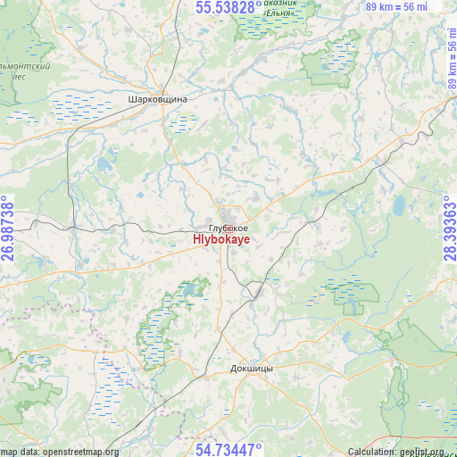
Hlybokaye GPS coordinates[2]
55° 8' 18.24" North, 27° 41' 25.8" East
| Map corner | latitude | longitude |
|---|---|---|
| Upper-left | 55.53828°, | 26.98738° |
| Center: | 55.1384°, | 27.6905° |
| Lower-right: | 54.73447°, | 28.39363° |
| Map W x H: | 89.4×89.4 km | = 55.6×55.6mi |
| max Lat: | 56.0147° ⇑5.9% North |
| Hlybokaye: | 55.1384° |
| min Lat: | ⇓94.1% South 51.75° |
| min Long | Hlybokaye | max Long |
| 23.37083° | 27.6905° | 32.578° |
| W 47.7%⇐ | ⇒52.3% E |
Elevation
Elevation of Hlybokaye is 159 m = 522 ft, and this is 9.6 m = 31 ft below average elevation for this country.
| Max E: |
309 m = 1014 ft | 57.2% |
| Avg. | 168.6 m = 553 ft | |
| Hlybokaye | 159 m = 522 ft | |
Min E: |
108 m = 354 ft | 42.8% |
See also: Belarus elevation on elevation.city.
Geographical zone
Hlybokaye is located in North temperate zone (between Tropic of Cancer and the Arctic Circle). Distance of this North polar circle is 1270.4 km =789.4 mi to North.| Distance of | km | miles | from Hlybokaye |
|---|---|---|---|
| North Pole | 3876.2 | 2408.6 | to North |
| Arctic Circle | 1270.4 | 789.4 | to North |
| Tropic Cancer | 3524.9 | 2190.3 | to South |
| Equator | 6130.8 | 3809.5 | to South |


Nearby cities:
15 places around Hlybokaye: (largest is in red/bold)
• Braslaw
69.3 km =43.1 mi,  323°
323°
• Budsław
41.7 km =25.9 mi,  205°
205°
• Byahoml’
51 km =31.7 mi,  152°
152°
• Dokshytsy
27.8 km =17.3 mi,  169°
169°
• Dzisna
57.8 km =35.9 mi,  34°
34°
• Kryvichy
53.8 km =33.4 mi, 208°
• Lyepyel’
70.4 km =43.7 mi,  113°
113°
• Mosar
17.4 km =10.8 mi,  302°
302°
• Myadzyel
56 km =34.8 mi,  239°
239°
• Myory
53.9 km =33.5 mi,  355°
355°
• Narach
67.6 km =42 mi,  247°
247°
• Pastavy
54.6 km =33.9 mi,  267°
267°
• Sharkawshchyna
29.2 km =18.1 mi,  331°
331°
• Ushachy
59 km =36.7 mi,  85°
85°
• Yazna
43.5 km =27 mi,  42°
42°
Sources, notices
• [Note1] Compared only with cities in Belarus existing in our database
• [Src1] Map data: © OpenStreetMap contributors (CC-BY-SA)
• [Src2] Other city data from geonames.org with taken over terms of usage.
• [Src3] Geographical zone / Annual Mean Temperature by Robert A. Rohde @ Wikipedia
