Drybin geodata
Drybin (Mogilev) is a seat of a second-order administrative division; located in Belarus in Europe/Minsk (GMT+3) time zone. With population of 2,900 people, there are 161 cities with bigger population in this country. Compared to other cities in Belarus, 74.7% of cities are located further ↓South; 95.7% of cities are located further ←West and 67.4% of cities have lower elevation than Drybin. Note1


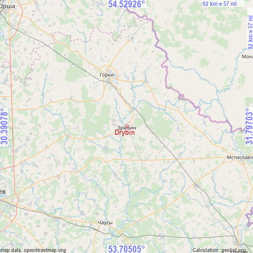
Drybin GPS coordinates[2]
54° 7' 9.12" North, 31° 5' 38.04" East
| Map corner | latitude | longitude |
|---|---|---|
| Upper-left | 54.52926°, | 30.39078° |
| Center: | 54.1192°, | 31.0939° |
| Lower-right: | 53.70505°, | 31.79703° |
| Map W x H: | 91.6×91.6 km | = 56.9×56.9mi |
| max Lat: | 56.0147° ⇑25.3% North |
| Drybin: | 54.1192° |
| min Lat: | ⇓74.7% South 51.75° |
| min Long | Drybin | max Long |
| 23.37083° | 31.0939° | 32.578° |
| W 95.7%⇐ | ⇒4.3% E |
Elevation
Elevation of Drybin is 179 m = 587 ft, and this is 10.4 m = 34 ft above average elevation for this country.
| Max E: |
309 m = 1014 ft | 32.6% |
| Drybin | 179 m 587 ft | |
| Avg. | 168.6 m = 553 ft | |
Min E: |
108 m = 354 ft | 67.4% |
See also: Belarus elevation on elevation.city.
Geographical zone
Drybin is located in North temperate zone (between Tropic of Cancer and the Arctic Circle). Distance of this North polar circle is 1383.7 km =859.8 mi to North.| Distance of | km | miles | from Drybin |
|---|---|---|---|
| North Pole | 3989.6 | 2479 | to North |
| Arctic Circle | 1383.7 | 859.8 | to North |
| Tropic Cancer | 3411.6 | 2119.9 | to South |
| Equator | 6017.5 | 3739.1 | to South |


Nearby cities:
15 places around Drybin: (largest is in red/bold)
• Chavusy
35.3 km =21.9 mi,  193°
193°
• Haradzishcha
31.6 km =19.6 mi,  284°
284°
• Harbavichy
42.2 km =26.2 mi,  217°
217°
• Horki
19.8 km =12.3 mi,  339°
339°
• Kadino
45.7 km =28.4 mi,  235°
235°
• Kamyennyya Lavy
52.1 km =32.4 mi,  266°
266°
• Khodasy
33 km =20.5 mi,  130°
130°
• Lotva
54.1 km =33.6 mi, 267°
• Mahilyow
53.9 km =33.5 mi,  245°
245°
• Mastok
44.3 km =27.5 mi, 249°
• Mstsislaw
42.5 km =26.4 mi,  105°
105°
• Palykavichy Pyershyya
50.2 km =31.2 mi, 252°
• Ramanavichy
44.9 km =27.9 mi,  231°
231°
• Shklow
53.5 km =33.2 mi, 281°
• Николаевка-2
50 km =31.1 mi, 248°
Sources, notices
• [Note1] Compared only with cities in Belarus existing in our database
• [Src1] Map data: © OpenStreetMap contributors (CC-BY-SA)
• [Src2] Other city data from geonames.org with taken over terms of usage.
• [Src3] Geographical zone / Annual Mean Temperature by Robert A. Rohde @ Wikipedia
