Horki geodata
Horki (Mogilev) is a seat of a second-order administrative division; located in Belarus in Europe/Minsk (GMT+3) time zone. With population of 33,897 people, there are 29 cities with bigger population in this country. Compared to other cities in Belarus, 79.3% of cities are located further ↓South; 94.7% of cities are located further ←West and 71.7% of cities have lower elevation than Horki. Note1


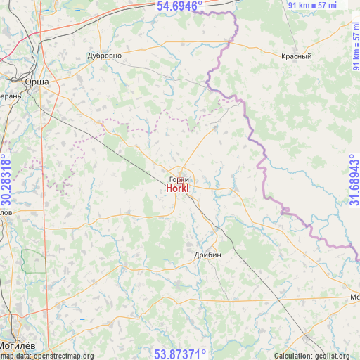
Horki GPS coordinates[2]
54° 17' 10.32" North, 30° 59' 10.68" East
| Map corner | latitude | longitude |
|---|---|---|
| Upper-left | 54.6946°, | 30.28318° |
| Center: | 54.2862°, | 30.9863° |
| Lower-right: | 53.87371°, | 31.68943° |
| Map W x H: | 91.3×91.3 km | = 56.7×56.7mi |
| max Lat: | 56.0147° ⇑20.7% North |
| Horki: | 54.2862° |
| min Lat: | ⇓79.3% South 51.75° |
| min Long | Horki | max Long |
| 23.37083° | 30.9863° | 32.578° |
| W 94.7%⇐ | ⇒5.3% E |
Elevation
Elevation of Horki is 182 m = 597 ft, and this is 13.4 m = 44 ft above average elevation for this country.
| Max E: |
309 m = 1014 ft | 28.3% |
| Horki | 182 m 597 ft | |
| Avg. | 168.6 m = 553 ft | |
Min E: |
108 m = 354 ft | 71.7% |
See also: Belarus elevation on elevation.city.
Geographical zone
Horki is located in North temperate zone (between Tropic of Cancer and the Arctic Circle). Distance of this North polar circle is 1365.1 km =848.2 mi to North.| Distance of | km | miles | from Horki |
|---|---|---|---|
| North Pole | 3971 | 2467.5 | to North |
| Arctic Circle | 1365.1 | 848.2 | to North |
| Tropic Cancer | 3430.1 | 2131.4 | to South |
| Equator | 6036.1 | 3750.7 | to South |


Nearby cities:
15 places around Horki: (largest is in red/bold)
• Balbasava
47.5 km =29.5 mi,  288°
288°
• Baran’
48.4 km =30.1 mi,  296°
296°
• Chavusy
53 km =32.9 mi,  181°
181°
• Drybin
19.8 km =12.3 mi,  159°
159°
• Dubrowna
37 km =23 mi,  328°
328°
• Haradzishcha
25.9 km =16.1 mi,  245°
245°
• Horad Orsha
45.4 km =28.2 mi, 304°
• Kamyennyya Lavy
49.9 km =31 mi,  244°
244°
• Khodasy
51.2 km =31.8 mi,  141°
141°
• Kopys’
45.4 km =28.2 mi,  275°
275°
• Lotva
51.3 km =31.9 mi, 246°
• Mastok
48.4 km =30.1 mi,  225°
225°
• Orsha
44.3 km =27.5 mi, 303°
• Palykavichy Pyershyya
52.8 km =32.8 mi, 230°
• Shklow
46.1 km =28.6 mi,  259°
259°
Sources, notices
• [Note1] Compared only with cities in Belarus existing in our database
• [Src1] Map data: © OpenStreetMap contributors (CC-BY-SA)
• [Src2] Other city data from geonames.org with taken over terms of usage.
• [Src3] Geographical zone / Annual Mean Temperature by Robert A. Rohde @ Wikipedia
