Saint-Maurice geodata
Saint-Maurice (Valais) is a seat of a second-order administrative division; located in Switzerland in Europe/Zurich (GMT+2) time zone. With population of 3,701 people, there are 479 cities with bigger population in this country. Compared to other cities in Switzerland, 93.7% of cities are located further ↑North; 87.7% of cities are located further →East and 81.2% of cities have higher elevation than Saint-Maurice. Note1


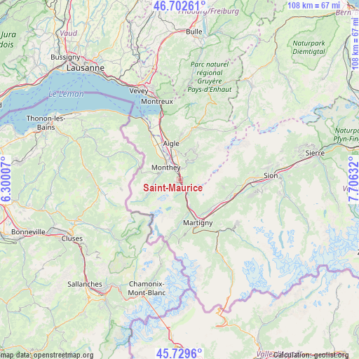
Saint-Maurice GPS coordinates[2]
46° 13' 5.736" North, 7° 0' 11.52" East
| Map corner | latitude | longitude |
|---|---|---|
| Upper-left | 46.70261°, | 6.30007° |
| Center: | 46.21826°, | 7.0032° |
| Lower-right: | 45.7296°, | 7.70632° |
| Map W x H: | 108.2×108.2 km | = 67.2×67.2mi |
| max Lat: | 47.76737° ⇑93.7% North |
| Saint-Maurice: | 46.21826° |
| min Lat: | ⇓6.3% South 45.83203° |
| min Long | Saint-Maurice | max Long |
| 5.97153° | 7.0032° | 10.44624° |
| W 12.3%⇐ | ⇒87.7% E |
Elevation
Elevation of Saint-Maurice is 419 m = 1375 ft, and this is 139.2 m = 457 ft below average elevation for this country.
| Max E: |
1845 m = 6053 ft | 81.2% |
| Avg. | 558.2 m = 1831 ft | |
| Saint-Maurice | 419 m = 1375 ft | |
Min E: |
197 m = 646 ft | 18.8% |
See also: Switzerland elevation on elevation.city.
Geographical zone
Saint-Maurice is located in North temperate zone (between Tropic of Cancer and the Arctic Circle). Distance of this North polar circle is 2262.2 km =1405.7 mi to North.| Distance of | km | miles | from Saint-Maurice |
|---|---|---|---|
| North Pole | 4868.1 | 3024.9 | to North |
| Arctic Circle | 2262.2 | 1405.7 | to North |
| Tropic Cancer | 2533.1 | 1574 | to South |
| Equator | 5139 | 3193.2 | to South |


Nearby cities:
15 places around Saint-Maurice: (largest is in red/bold)
• Aigle
11.5 km =7.1 mi,  345°
345°
• Bex
3.5 km =2.2 mi,  8°
8°
• Champéry
11.4 km =7.1 mi,  245°
245°
• Collombey
7.5 km =4.7 mi,  325°
325°
• Dorénaz
8.3 km =5.2 mi,  158°
158°
• Evionnaz
4.4 km =2.7 mi, 160°
• Gryon
7.6 km =4.7 mi,  35°
35°
• Mex
3.7 km =2.3 mi,  183°
183°
• Monthey
5.5 km =3.4 mi,  316°
316°
• Morgins
11.9 km =7.4 mi,  281°
281°
• Ollon
8.6 km =5.3 mi, 354°
• Salvan
11.1 km =6.9 mi,  173°
173°
• Troistorrents
6.8 km =4.2 mi, 279°
• Vernayaz
9.5 km =5.9 mi, 163°
• Villars-sur-Ollon
9.8 km =6.1 mi,  24°
24°
Sources, notices
• [Note1] Compared only with cities in Switzerland existing in our database
• [Src1] Map data: © OpenStreetMap contributors (CC-BY-SA)
• [Src2] Other city data from geonames.org with taken over terms of usage.
• [Src3] Geographical zone / Annual Mean Temperature by Robert A. Rohde @ Wikipedia
