Vernayaz geodata
Vernayaz (Valais) is a populated place; located in Switzerland in Europe/Zurich (GMT+2) time zone. With population of 1,612 people, there are 974 cities with bigger population in this country. Compared to other cities in Switzerland, 97% of cities are located further ↑North; 86.8% of cities are located further →East and 59.8% of cities have higher elevation than Vernayaz. Note1


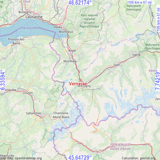
Vernayaz GPS coordinates[2]
46° 8' 12.012" North, 7° 2' 20.616" East
| Map corner | latitude | longitude |
|---|---|---|
| Upper-left | 46.62174°, | 6.33594° |
| Center: | 46.13667°, | 7.03906° |
| Lower-right: | 45.64729°, | 7.74219° |
| Map W x H: | 108.3×108.3 km | = 67.3×67.3mi |
| max Lat: | 47.76737° ⇑97% North |
| Vernayaz: | 46.13667° |
| min Lat: | ⇓3% South 45.83203° |
| min Long | Vernayaz | max Long |
| 5.97153° | 7.03906° | 10.44624° |
| W 13.2%⇐ | ⇒86.8% E |
Elevation
Elevation of Vernayaz is 455 m = 1493 ft, and this is 103.2 m = 339 ft below average elevation for this country.
| Max E: |
1845 m = 6053 ft | 59.8% |
| Avg. | 558.2 m = 1831 ft | |
| Vernayaz | 455 m = 1493 ft | |
Min E: |
197 m = 646 ft | 40.2% |
See also: Switzerland elevation on elevation.city.
Geographical zone
Vernayaz is located in North temperate zone (between Tropic of Cancer and the Arctic Circle). Distance of this North polar circle is 2271.3 km =1411.3 mi to North.| Distance of | km | miles | from Vernayaz |
|---|---|---|---|
| North Pole | 4877.1 | 3030.5 | to North |
| Arctic Circle | 2271.3 | 1411.3 | to North |
| Tropic Cancer | 2524 | 1568.3 | to South |
| Equator | 5129.9 | 3187.6 | to South |


Nearby cities:
15 places around Vernayaz: (largest is in red/bold)
• Bex
12.8 km =8 mi,  349°
349°
• Champéry
13.8 km =8.6 mi,  288°
288°
• Charrat
7.2 km =4.5 mi,  100°
100°
• Dorénaz
1.4 km =0.9 mi,  12°
12°
• Evionnaz
5.1 km =3.2 mi, 345°
• Fully
5.8 km =3.6 mi,  87°
87°
• Martigny-Combe
6.6 km =4.1 mi,  171°
171°
• Martigny-Ville
4.6 km =2.9 mi,  145°
145°
• Mex
6.2 km =3.9 mi,  331°
331°
• Saillon
12 km =7.5 mi,  71°
71°
• Saint-Maurice
9.5 km =5.9 mi,  343°
343°
• Salvan
2.4 km =1.5 mi,  215°
215°
• Saxon
10.6 km =6.6 mi,  82°
82°
• Sembrancher
11 km =6.8 mi,  126°
126°
• Troistorrents
14 km =8.7 mi,  317°
317°
Sources, notices
• [Note1] Compared only with cities in Switzerland existing in our database
• [Src1] Map data: © OpenStreetMap contributors (CC-BY-SA)
• [Src2] Other city data from geonames.org with taken over terms of usage.
• [Src3] Geographical zone / Annual Mean Temperature by Robert A. Rohde @ Wikipedia
