Ligornetto geodata
Ligornetto (Ticino) is a populated place; located in Switzerland in Europe/Zurich (GMT+2) time zone. With population of 1,524 people, there are 1022 cities with bigger population in this country. Compared to other cities in Switzerland, 99.6% of cities are located further ↑North; 86.2% of cities are located further ←West and 94.9% of cities have higher elevation than Ligornetto. Note1


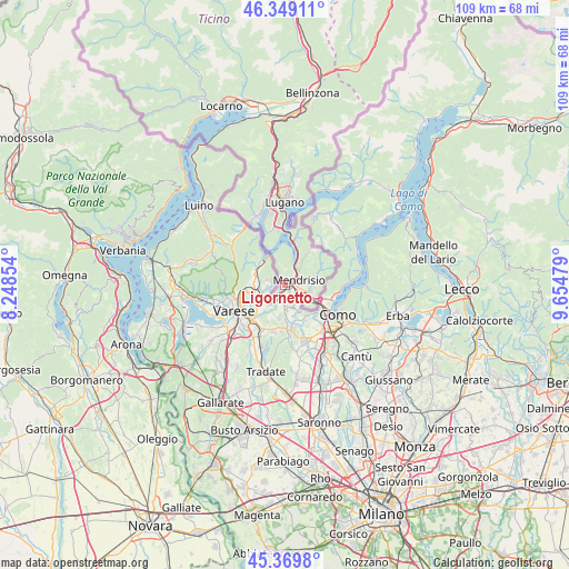
Ligornetto GPS coordinates[2]
45° 51' 41.796" North, 8° 57' 5.976" East
| Map corner | latitude | longitude |
|---|---|---|
| Upper-left | 46.34911°, | 8.24854° |
| Center: | 45.86161°, | 8.95166° |
| Lower-right: | 45.3698°, | 9.65479° |
| Map W x H: | 108.9×108.9 km | = 67.7×67.7mi |
| max Lat: | 47.76737° ⇑99.6% North |
| Ligornetto: | 45.86161° |
| min Lat: | ⇓0.4% South 45.83203° |
| min Long | Ligornetto | max Long |
| 5.97153° | 8.95166° | 10.44624° |
| W 86.2%⇐ | ⇒13.8% E |
Elevation
Elevation of Ligornetto is 357 m = 1171 ft, and this is 201.2 m = 660 ft below average elevation for this country.
| Max E: |
1845 m = 6053 ft | 94.9% |
| Avg. | 558.2 m = 1831 ft | |
| Ligornetto | 357 m = 1171 ft | |
Min E: |
197 m = 646 ft | 5.1% |
See also: Switzerland elevation on elevation.city.
Geographical zone
Ligornetto is located in North temperate zone (between Tropic of Cancer and the Arctic Circle). Distance of this North polar circle is 2301.8 km =1430.3 mi to North.| Distance of | km | miles | from Ligornetto |
|---|---|---|---|
| North Pole | 4907.7 | 3049.5 | to North |
| Arctic Circle | 2301.8 | 1430.3 | to North |
| Tropic Cancer | 2493.4 | 1549.3 | to South |
| Equator | 5099.3 | 3168.6 | to South |


Nearby cities:
15 places around Ligornetto: (largest is in red/bold)
• Arzo
1.8 km =1.1 mi,  332°
332°
• Balerna
4.6 km =2.9 mi,  111°
111°
• Capolago
5.1 km =3.2 mi,  24°
24°
• Castel San Pietro
4.4 km =2.7 mi,  89°
89°
• Chiasso
7 km =4.3 mi,  118°
118°
• Genestrerio
1.2 km =0.7 mi,  141°
141°
• Melano
7.2 km =4.5 mi, 20°
• Mendrisio
2.5 km =1.6 mi,  67°
67°
• Morbio Inferiore
5.4 km =3.4 mi,  104°
104°
• Morbio Superiore
5.5 km =3.4 mi, 91°
• Morcote
7.6 km =4.7 mi,  338°
338°
• Novazzano
3.3 km =2.1 mi,  134°
134°
• Riva San Vitale
4.7 km =2.9 mi, 19°
• Rovio
8.4 km =5.2 mi, 18°
• Stabio
1.9 km =1.2 mi,  218°
218°
Sources, notices
• [Note1] Compared only with cities in Switzerland existing in our database
• [Src1] Map data: © OpenStreetMap contributors (CC-BY-SA)
• [Src2] Other city data from geonames.org with taken over terms of usage.
• [Src3] Geographical zone / Annual Mean Temperature by Robert A. Rohde @ Wikipedia
