Eysins geodata
Eysins (Vaud) is a populated place; located in Switzerland in Europe/Zurich (GMT+2) time zone. With population of 831 people, there are 1473 cities with bigger population in this country. Compared to other cities in Switzerland, 88.4% of cities are located further ↑North; 98.2% of cities are located further →East and 70.8% of cities have higher elevation than Eysins. Note1


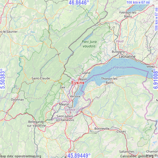
Eysins GPS coordinates[2]
46° 22' 54.12" North, 6° 12' 25.02" East
| Map corner | latitude | longitude |
|---|---|---|
| Upper-left | 46.8646°, | 5.50383° |
| Center: | 46.3817°, | 6.20695° |
| Lower-right: | 45.89449°, | 6.91008° |
| Map W x H: | 107.9×107.9 km | = 67×67mi |
| max Lat: | 47.76737° ⇑88.4% North |
| Eysins: | 46.3817° |
| min Lat: | ⇓11.6% South 45.83203° |
| min Long | Eysins | max Long |
| 5.97153° | 6.20695° | 10.44624° |
| W 1.8%⇐ | ⇒98.2% E |
Elevation
Elevation of Eysins is 438 m = 1437 ft, and this is 120.2 m = 394 ft below average elevation for this country.
| Max E: |
1845 m = 6053 ft | 70.8% |
| Avg. | 558.2 m = 1831 ft | |
| Eysins | 438 m = 1437 ft | |
Min E: |
197 m = 646 ft | 29.2% |
See also: Switzerland elevation on elevation.city.
Geographical zone
Eysins is located in North temperate zone (between Tropic of Cancer and the Arctic Circle). Distance of this North polar circle is 2244 km =1394.4 mi to North.| Distance of | km | miles | from Eysins |
|---|---|---|---|
| North Pole | 4849.9 | 3013.6 | to North |
| Arctic Circle | 2244 | 1394.4 | to North |
| Tropic Cancer | 2551.2 | 1585.2 | to South |
| Equator | 5157.2 | 3204.5 | to South |


Nearby cities:
15 places around Eysins: (largest is in red/bold)
• Begnins
7.3 km =4.5 mi,  25°
25°
• Bogis-Bossey
4.4 km =2.7 mi,  225°
225°
• Borex
2.4 km =1.5 mi,  262°
262°
• Chéserex
3.1 km =1.9 mi,  308°
308°
• Coppet
7.3 km =4.5 mi,  189°
189°
• Crassier
3.4 km =2.1 mi, 256°
• Céligny
3.6 km =2.2 mi, 194°
• Founex
5.6 km =3.5 mi, 191°
• Genolier
6 km =3.7 mi,  8°
8°
• Gingins
3.8 km =2.4 mi,  324°
324°
• Gland
6.5 km =4 mi,  48°
48°
• Nyon
2.5 km =1.6 mi,  86°
86°
• Prangins
3.6 km =2.2 mi,  65°
65°
• Saint-Cergue
8.1 km =5 mi,  331°
331°
• Trélex
3.7 km =2.3 mi,  1°
1°
Sources, notices
• [Note1] Compared only with cities in Switzerland existing in our database
• [Src1] Map data: © OpenStreetMap contributors (CC-BY-SA)
• [Src2] Other city data from geonames.org with taken over terms of usage.
• [Src3] Geographical zone / Annual Mean Temperature by Robert A. Rohde @ Wikipedia
