Bülach / Chröpfli geodata
Bülach / Chröpfli (Zurich) is a section of populated place; located in Switzerland in Europe/Zurich (GMT+2) time zone. With population of 849 people, there are 1457 cities with bigger population in this country. Compared to other cities in Switzerland, 93.1% of cities are located further ↓South; 61.5% of cities are located further ←West and 59.8% of cities have higher elevation than Bülach / Chröpfli. Note1


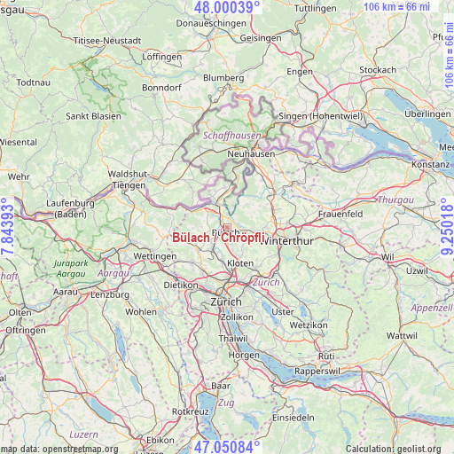
Bülach / Chröpfli GPS coordinates[2]
47° 31' 39.936" North, 8° 32' 49.38" East
| Map corner | latitude | longitude |
|---|---|---|
| Upper-left | 48.00039°, | 7.84393° |
| Center: | 47.52776°, | 8.54705° |
| Lower-right: | 47.05084°, | 9.25018° |
| Map W x H: | 105.6×105.6 km | = 65.6×65.6mi |
| max Lat: | 47.76737° ⇑6.9% North |
| Bülach / Chröpfli: | 47.52776° |
| min Lat: | ⇓93.1% South 45.83203° |
| min Long | Bülach / Chrö | max Long |
| 5.97153° | 8.54705° | 10.44624° |
| W 61.5%⇐ | ⇒38.5% E |
Elevation
Elevation of Bülach / Chröpfli is 455 m = 1493 ft, and this is 103.2 m = 339 ft below average elevation for this country.
| Max E: |
1845 m = 6053 ft | 59.8% |
| Avg. | 558.2 m = 1831 ft | |
| Bülach / Chröpfli | 455 m = 1493 ft | |
Min E: |
197 m = 646 ft | 40.2% |
See also: Switzerland elevation on elevation.city.
Geographical zone
Bülach / Chröpfli is located in North temperate zone (between Tropic of Cancer and the Arctic Circle). Distance of this North polar circle is 2116.6 km =1315.2 mi to North.| Distance of | km | miles | from Bülach / Chröpfli |
|---|---|---|---|
| North Pole | 4722.5 | 2934.4 | to North |
| Arctic Circle | 2116.6 | 1315.2 | to North |
| Tropic Cancer | 2678.7 | 1664.5 | to South |
| Equator | 5284.6 | 3283.7 | to South |


Nearby cities:
15 places around Bülach / Chröpfli: (largest is in red/bold)
• Bachenbülach
2.7 km =1.7 mi,  182°
182°
• Bückler-Dörnler
3.2 km =2 mi,  227°
227°
• Bülach
0.8 km =0.5 mi,  217°
217°
• Bülach / Altstadt
1.2 km =0.7 mi,  203°
203°
• Bülach / Grossstein
1.4 km =0.9 mi, 231°
• Bülach / Gstückt
0.5 km =0.3 mi,  165°
165°
• Bülach / Herti
1.3 km =0.8 mi, 217°
• Bülach / Seematt
1.2 km =0.7 mi, 181°
• Bülach / Soligänter
0.5 km =0.3 mi,  250°
250°
• Embrach / Ebnet
3.3 km =2.1 mi,  112°
112°
• Embrach / Kellersacker
3.6 km =2.2 mi, 113°
• Freienstein
2.9 km =1.8 mi,  78°
78°
• Hochfelden
2.4 km =1.5 mi,  256°
256°
• Höri
3.4 km =2.1 mi, 230°
• Rorbas
2.2 km =1.4 mi, 80°
Sources, notices
• [Note1] Compared only with cities in Switzerland existing in our database
• [Src1] Map data: © OpenStreetMap contributors (CC-BY-SA)
• [Src2] Other city data from geonames.org with taken over terms of usage.
• [Src3] Geographical zone / Annual Mean Temperature by Robert A. Rohde @ Wikipedia
