Bülach / Herti geodata
Bülach / Herti (Zurich) is a section of populated place; located in Switzerland in Europe/Zurich (GMT+2) time zone. With population of 808 people, there are 1487 cities with bigger population in this country. Compared to other cities in Switzerland, 91.9% of cities are located further ↓South; 60.4% of cities are located further ←West and 79.2% of cities have higher elevation than Bülach / Herti. Note1


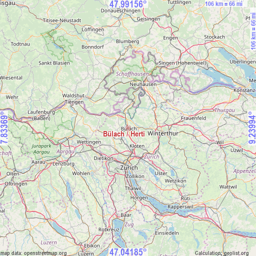
Bülach / Herti GPS coordinates[2]
47° 31' 7.86" North, 8° 32' 12.552" East
| Map corner | latitude | longitude |
|---|---|---|
| Upper-left | 47.99156°, | 7.83369° |
| Center: | 47.51885°, | 8.53682° |
| Lower-right: | 47.04185°, | 9.23994° |
| Map W x H: | 105.6×105.6 km | = 65.6×65.6mi |
| max Lat: | 47.76737° ⇑8.1% North |
| Bülach / Herti: | 47.51885° |
| min Lat: | ⇓91.9% South 45.83203° |
| min Long | Bülach / Herti | max Long |
| 5.97153° | 8.53682° | 10.44624° |
| W 60.4%⇐ | ⇒39.6% E |
Elevation
Elevation of Bülach / Herti is 423 m = 1388 ft, and this is 135.2 m = 444 ft below average elevation for this country.
| Max E: |
1845 m = 6053 ft | 79.2% |
| Avg. | 558.2 m = 1831 ft | |
| Bülach / Herti | 423 m = 1388 ft | |
Min E: |
197 m = 646 ft | 20.8% |
See also: Switzerland elevation on elevation.city.
Geographical zone
Bülach / Herti is located in North temperate zone (between Tropic of Cancer and the Arctic Circle). Distance of this North polar circle is 2117.6 km =1315.8 mi to North.| Distance of | km | miles | from Bülach / Herti |
|---|---|---|---|
| North Pole | 4723.5 | 2935 | to North |
| Arctic Circle | 2117.6 | 1315.8 | to North |
| Tropic Cancer | 2677.7 | 1663.8 | to South |
| Equator | 5283.6 | 3283.1 | to South |


Nearby cities:
15 places around Bülach / Herti: (largest is in red/bold)
• Bachenbülach
1.9 km =1.2 mi,  159°
159°
• Bückler-Dörnler
2 km =1.2 mi,  233°
233°
• Bülach
0.4 km =0.2 mi,  38°
38°
• Bülach / Altstadt
0.3 km =0.2 mi,  116°
116°
• Bülach / Chröpfli
1.3 km =0.8 mi, 37°
• Bülach / Grossstein
0.4 km =0.2 mi,  286°
286°
• Bülach / Gstückt
1 km =0.6 mi,  60°
60°
• Bülach / Seematt
0.8 km =0.5 mi,  104°
104°
• Bülach / Soligänter
0.9 km =0.6 mi,  20°
20°
• Hochfelden
1.6 km =1 mi,  284°
284°
• Höri
2.2 km =1.4 mi,  237°
237°
• Niederglatt / Grafschaft
3.7 km =2.3 mi,  222°
222°
• Ober-Höri
3.4 km =2.1 mi, 240°
• Rorbas
3.2 km =2 mi,  65°
65°
• Winkel
3.3 km =2.1 mi, 157°
Sources, notices
• [Note1] Compared only with cities in Switzerland existing in our database
• [Src1] Map data: © OpenStreetMap contributors (CC-BY-SA)
• [Src2] Other city data from geonames.org with taken over terms of usage.
• [Src3] Geographical zone / Annual Mean Temperature by Robert A. Rohde @ Wikipedia
