Adliswil / Adliswil (Stadtkern) geodata
Adliswil / Adliswil (Stadtkern) (Zurich) is a section of populated place; located in Switzerland in Europe/Zurich (GMT+2) time zone. With population of 2,538 people, there are 688 cities with bigger population in this country. Compared to other cities in Switzerland, 59.5% of cities are located further ↓South; 59.4% of cities are located further ←West and 63.8% of cities have higher elevation than Adliswil / Adliswil (Stadtkern). Note1
Current local time in Adliswil / Adliswil (Stadtkern):
06:19 AM, SaturdayDifference from your time zone: hours


Adliswil / Adliswil (Stadtkern) GPS coordinates[2]
47° 18' 40.608" North, 8° 31' 36.3" East
| Map corner | latitude | longitude |
|---|---|---|
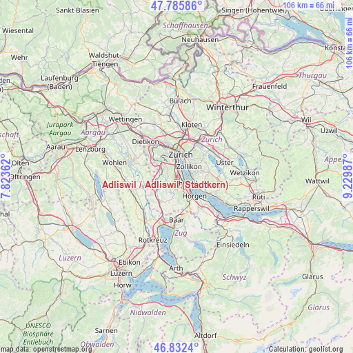
| Upper-left | 47.78586°, | 7.82362° |
| Center: | 47.31128°, | 8.52675° |
| Lower-right: | 46.8324°, | 9.22987° |
| Map W x H: | 106×106 km | = 65.9×65.9mi |
| max Lat: | 47.76737° ⇑40.5% North |
| Adliswil / Adliswil (Stadtkern): | 47.31128° |
| min Lat: | ⇓59.5% South 45.83203° |
| min Long | Adliswil / Adli | max Long |
| 5.97153° | 8.52675° | 10.44624° |
| W 59.4%⇐ | ⇒40.6% E |
Elevation
Elevation of Adliswil / Adliswil (Stadtkern) is 448 m = 1470 ft, and this is 110.2 m = 362 ft below average elevation for this country.
| Max E: |
1845 m = 6053 ft | 63.8% |
| Avg. | 558.2 m = 1831 ft | |
| Adliswil / Adliswil (Stadtkern) | 448 m = 1470 ft | |
Min E: |
197 m = 646 ft | 36.2% |
See also: Switzerland elevation on elevation.city.
Geographical zone
Adliswil / Adliswil (Stadtkern) is located in North temperate zone (between Tropic of Cancer and the Arctic Circle). Distance of this North polar circle is 2140.7 km =1330.2 mi to North.| Distance of | km | miles | from Adliswil / Adliswil (Stadtkern) |
|---|---|---|---|
| North Pole | 4746.5 | 2949.3 | to North |
| Arctic Circle | 2140.7 | 1330.2 | to North |
| Tropic Cancer | 2654.6 | 1649.5 | to South |
| Equator | 5260.5 | 3268.7 | to South |


Nearby cities:
15 places around Adliswil / Adliswil (Stadtkern): (largest is in red/bold)
• Adliswil
0.2 km =0.1 mi,  227°
227°
• Adliswil / Buttenau
1.2 km =0.7 mi,  182°
182°
• Adliswil / Büchel
1.3 km =0.8 mi,  195°
195°
• Adliswil / Hündli-Zopf
0.8 km =0.5 mi,  313°
313°
• Adliswil / Lebern
0.7 km =0.4 mi,  47°
47°
• Adliswil / Oberleimbach
1.3 km =0.8 mi,  318°
318°
• Adliswil / Sihlau
0.9 km =0.6 mi, 177°
• Adliswil / Sihlhof
1.3 km =0.8 mi,  342°
342°
• Adliswil / Sonnenberg
0.5 km =0.3 mi,  247°
247°
• Adliswil / Sood
0.8 km =0.5 mi,  347°
347°
• Adliswil / Tal
0.6 km =0.4 mi,  88°
88°
• Adliswil / Wacht
0.5 km =0.3 mi,  133°
133°
• Adliswil / Wanneten
0.9 km =0.6 mi,  210°
210°
• Kilchberg / Kilchberg (Dorfkern)
1.6 km =1 mi, 51°
• Kilchberg / Schwanden
1.8 km =1.1 mi,  66°
66°
Sources, notices
• [Note1] Compared only with cities in Switzerland existing in our database
• [Src1] Map data: © OpenStreetMap contributors (CC-BY-SA)
• [Src2] Other city data from geonames.org with taken over terms of usage.
• [Src3] Geographical zone / Annual Mean Temperature by Robert A. Rohde @ Wikipedia
