Adliswil / Sihlhof geodata
Adliswil / Sihlhof (Zurich) is a section of populated place; located in Switzerland in Europe/Zurich (GMT+2) time zone. With population of 585 people, there are 1708 cities with bigger population in this country. Compared to other cities in Switzerland, 61.3% of cities are located further ↓South; 58.7% of cities are located further ←West and 67.9% of cities have higher elevation than Adliswil / Sihlhof. Note1


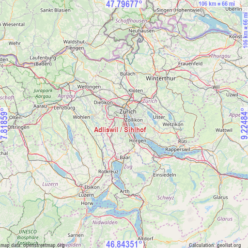
Adliswil / Sihlhof GPS coordinates[2]
47° 19' 20.244" North, 8° 31' 18.192" East
| Map corner | latitude | longitude |
|---|---|---|
| Upper-left | 47.79677°, | 7.81859° |
| Center: | 47.32229°, | 8.52172° |
| Lower-right: | 46.84351°, | 9.22484° |
| Map W x H: | 106×106 km | = 65.9×65.9mi |
| max Lat: | 47.76737° ⇑38.7% North |
| Adliswil / Sihlhof: | 47.32229° |
| min Lat: | ⇓61.3% South 45.83203° |
| min Long | Adliswil / Sihl | max Long |
| 5.97153° | 8.52172° | 10.44624° |
| W 58.7%⇐ | ⇒41.3% E |
Elevation
Elevation of Adliswil / Sihlhof is 441 m = 1447 ft, and this is 117.2 m = 385 ft below average elevation for this country.
| Max E: |
1845 m = 6053 ft | 67.9% |
| Avg. | 558.2 m = 1831 ft | |
| Adliswil / Sihlhof | 441 m = 1447 ft | |
Min E: |
197 m = 646 ft | 32.1% |
See also: Switzerland elevation on elevation.city.
Geographical zone
Adliswil / Sihlhof is located in North temperate zone (between Tropic of Cancer and the Arctic Circle). Distance of this North polar circle is 2139.4 km =1329.4 mi to North.| Distance of | km | miles | from Adliswil / Sihlhof |
|---|---|---|---|
| North Pole | 4745.3 | 2948.6 | to North |
| Arctic Circle | 2139.4 | 1329.4 | to North |
| Tropic Cancer | 2655.8 | 1650.2 | to South |
| Equator | 5261.7 | 3269.5 | to South |


Nearby cities:
15 places around Adliswil / Sihlhof: (largest is in red/bold)
• Adliswil
1.4 km =0.9 mi,  170°
170°
• Adliswil / Adliswil (Stadtkern)
1.3 km =0.8 mi,  162°
162°
• Adliswil / Hündli-Zopf
0.7 km =0.4 mi,  198°
198°
• Adliswil / Lebern
1.2 km =0.7 mi,  130°
130°
• Adliswil / Oberleimbach
0.6 km =0.4 mi,  245°
245°
• Adliswil / Sonnenberg
1.4 km =0.9 mi,  183°
183°
• Adliswil / Sood
0.4 km =0.2 mi,  154°
154°
• Adliswil / Tal
1.5 km =0.9 mi,  141°
141°
• Adliswil / Wacht
1.7 km =1.1 mi, 154°
• Kilchberg / Bächler-Stocken
1.5 km =0.9 mi,  67°
67°
• Kilchberg / Hornhalden
1.8 km =1.1 mi,  57°
57°
• Kilchberg / Kilchberg (Dorfkern)
1.6 km =1 mi,  98°
98°
• Zürich (Kreis 2)
1.7 km =1.1 mi,  358°
358°
• Zürich (Kreis 2) / Mittel-Leimbach
0.7 km =0.4 mi,  300°
300°
• Zürich (Kreis 2) / Unter-Leimbach
1.4 km =0.9 mi,  336°
336°
Sources, notices
• [Note1] Compared only with cities in Switzerland existing in our database
• [Src1] Map data: © OpenStreetMap contributors (CC-BY-SA)
• [Src2] Other city data from geonames.org with taken over terms of usage.
• [Src3] Geographical zone / Annual Mean Temperature by Robert A. Rohde @ Wikipedia
