Cámeron geodata
Cámeron (Region of Magallanes) is a seat of a third-order administrative division; located in Chile in America/Punta_Arenas (GMT-3) time zone. In our database, there are 135 cities with bigger population. Compared to other cities in Chile, 99.3% of cities are located further ↑North; 96.6% of cities are located further ←West and 80.7% of cities have higher elevation than Cámeron. Note1
Administrative division(s):
- Level 1: Region of Magallanes
- Level 2: Provincia de Tierra del Fuego
- Level 3: Timaukel


Cámeron GPS coordinates[2]
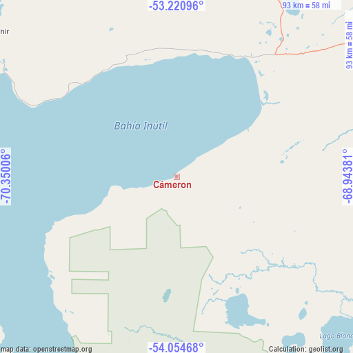
53° 38' 23.568" South, 69° 38' 48.948" West
| Map corner | latitude | longitude |
|---|---|---|
| Upper-left | -53.22096°, | -70.35006° |
| Center: | -53.63988°, | -69.64693° |
| Lower-right: | -54.05468°, | -68.94381° |
| Map W x H: | 92.7×92.7 km | = 57.6×57.6mi |
| max Lat: | -18.19821° ⇑99.3% North |
| Cámeron: | -53.63988° |
| min Lat: | ⇓0.7% South -54.93355° |
| min Long | Cámeron | max Long |
| -109.42438° | -69.64693° | -67.60963° |
| W 96.6%⇐ | ⇒3.4% E |
Elevation
Elevation of Cámeron is 28 m = 92 ft, and this is 245 m = 804 ft below average elevation for this country.
| Max E: |
3544 m = 11627 ft | 80.7% |
| Avg. | 273 m = 896 ft | |
| Cámeron | 28 m = 92 ft | |
Min E: |
1 m = 3 ft | 19.3% |
See also: Chile elevation on elevation.city.
Geographical zone
Cámeron is located in South temperate zone (between Tropic of Capricorn and the Antarctic Circle). Distance of this South polar circle is 1437 km =892.9 mi to South.| Distance of | km | miles | from Cámeron |
|---|---|---|---|
| Equator | 5964.2 | 3706 | to North |
| Tropic Capricorn | 3358.3 | 2086.8 | to North |
| Antarctic Circle | 1437 | 892.9 | to South |
| South Pole | 4042.9 | 2512.1 | to South |


Nearby cities:
4 places around Cámeron: (largest is in red/bold)
• Porvenir
61.1 km =38 mi,  308°
308°
• Puerto Natales
286.7 km =178.1 mi,  317°
317°
• Puerto Williams
195.4 km =121.4 mi,  137°
137°
• Punta Arenas
99.7 km =62 mi,  302°
302°
Sources, notices
• [Note1] Compared only with cities in Chile existing in our database
• [Src1] Map data: © OpenStreetMap contributors (CC-BY-SA)
• [Src2] Other city data from geonames.org with taken over terms of usage.
• [Src3] Geographical zone / Annual Mean Temperature by Robert A. Rohde @ Wikipedia
