Lintan Chengguanzhen geodata
Lintan Chengguanzhen (Gansu) is a seat of a third-order administrative division; located in China in Asia/Shanghai (GMT+8) time zone. In our database, there are 1268 cities with bigger population. Compared to other cities in China, 73.7% of cities are located further ↓South; 91.1% of cities are located further →East and 96.4% of cities have lower elevation than Lintan Chengguanzhen. Note1


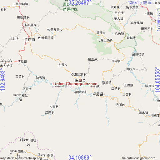
Lintan Chengguanzhen GPS coordinates[2]
34° 41' 19.86" North, 103° 21' 8.712" East
| Map corner | latitude | longitude |
|---|---|---|
| Upper-left | 35.26497°, | 102.6493° |
| Center: | 34.68885°, | 103.35242° |
| Lower-right: | 34.10869°, | 104.05555° |
| Map W x H: | 128.6×128.6 km | = 79.9×79.9mi |
| max Lat: | 53.31946° ⇑26.3% North |
| Lintan Chengguanzhen: | 34.68885° |
| min Lat: | ⇓73.7% South 18.22056° |
| min Long | Lintan Chenggua | max Long |
| 75.07348° | 103.35242° | 134.28917° |
| W 8.9%⇐ | ⇒91.1% E |
Elevation
Elevation of Lintan Chengguanzhen is 2762 m = 9062 ft, and this is 2277.2 m = 7471 ft above average elevation for this country.
| Max E: |
5622 m = 18445 ft | 3.6% |
| Lintan Chengguanzhen | 2762 m 9062 ft | |
| Avg. | 484.8 m = 1591 ft | |
Min E: |
-3 m = -10 ft | 96.4% |
See also: China elevation on elevation.city.
Geographical zone
Lintan Chengguanzhen is located in North temperate zone (between Tropic of Cancer and the Arctic Circle). Distance of this Northern Tropic circle is 1251.1 km =777.4 mi to South.| Distance of | km | miles | from Lintan Chengguanzhen |
|---|---|---|---|
| North Pole | 6150 | 3821.4 | to North |
| Arctic Circle | 3544.1 | 2202.2 | to North |
| Tropic Cancer | 1251.1 | 777.4 | to South |
| Equator | 3857 | 2396.6 | to South |


Nearby cities:
15 places around Lintan Chengguanzhen: (largest is in red/bold)
• Changchuan
7.7 km =4.8 mi,  67°
67°
• Chubu
9.6 km =6 mi,  215°
215°
• Dazu
13.4 km =8.3 mi,  151°
151°
• Guzhan
5.1 km =3.2 mi,  277°
277°
• Jiamaogong
23.9 km =14.9 mi, 284°
• Kache
9.7 km =6 mi,  181°
181°
• Liulin
17.7 km =11 mi,  128°
128°
• Liushun
17.8 km =11.1 mi,  104°
104°
• Mu’er
25.3 km =15.7 mi,  122°
122°
• Qiagai
19.9 km =12.4 mi,  29°
29°
• Shencang
5.7 km =3.5 mi, 26°
• Wanmao
18.6 km =11.6 mi,  311°
311°
• Xincheng
21.5 km =13.4 mi,  94°
94°
• Yangyong
11.9 km =7.4 mi,  113°
113°
• Zhuolu
4.9 km =3 mi,  346°
346°
Sources, notices
• [Note1] Compared only with cities in China existing in our database
• [Src1] Map data: © OpenStreetMap contributors (CC-BY-SA)
• [Src2] Other city data from geonames.org with taken over terms of usage.
• [Src3] Geographical zone / Annual Mean Temperature by Robert A. Rohde @ Wikipedia
