Zhouwangmiao geodata
Zhouwangmiao (Zhejiang) is a seat of a fourth-order administrative division; located in China in Asia/Shanghai (GMT+8) time zone. In our database, there are 1268 cities with bigger population. Compared to other cities in China, 50.1% of cities are located further ↓South; 85.1% of cities are located further ←West and 89.9% of cities have higher elevation than Zhouwangmiao. Note1


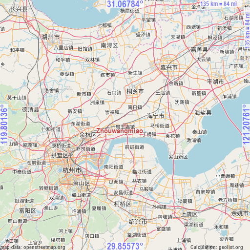
Zhouwangmiao GPS coordinates[2]
30° 27' 49.212" North, 120° 30' 16.128" East
| Map corner | latitude | longitude |
|---|---|---|
| Upper-left | 31.06784°, | 119.80136° |
| Center: | 30.46367°, | 120.50448° |
| Lower-right: | 29.85573°, | 121.20761° |
| Map W x H: | 134.8×134.8 km | = 83.8×83.8mi |
| max Lat: | 53.31946° ⇑49.9% North |
| Zhouwangmiao: | 30.46367° |
| min Lat: | ⇓50.1% South 18.22056° |
| min Long | Zhouwangmiao | max Long |
| 75.07348° | 120.50448° | 134.28917° |
| W 85.1%⇐ | ⇒14.9% E |
Elevation
Elevation of Zhouwangmiao is 10 m = 33 ft, and this is 474.8 m = 1558 ft below average elevation for this country.
| Max E: |
5622 m = 18445 ft | 89.9% |
| Avg. | 484.8 m = 1591 ft | |
| Zhouwangmiao | 10 m = 33 ft | |
Min E: |
-3 m = -10 ft | 10.1% |
See also: China elevation on elevation.city.
Geographical zone
Zhouwangmiao is located in North temperate zone (between Tropic of Cancer and the Arctic Circle). Distance of this Northern Tropic circle is 781.3 km =485.5 mi to South.| Distance of | km | miles | from Zhouwangmiao |
|---|---|---|---|
| North Pole | 6619.8 | 4113.4 | to North |
| Arctic Circle | 4013.9 | 2494.1 | to North |
| Tropic Cancer | 781.3 | 485.5 | to South |
| Equator | 3387.2 | 2104.7 | to South |


Nearby cities:
15 places around Zhouwangmiao: (largest is in red/bold)
• Chang’an
5.9 km =3.7 mi,  261°
261°
• Chongfu
10.3 km =6.4 mi,  316°
316°
• Dama
16.2 km =10.1 mi,  285°
285°
• Dingqiao
13.7 km =8.5 mi,  109°
109°
• Gaoqiao
7.8 km =4.8 mi,  28°
28°
• Haining
19.2 km =11.9 mi,  65°
65°
• Hezhuang
18.7 km =11.6 mi,  192°
192°
• Maqiao
18.5 km =11.5 mi,  89°
89°
• Shimen
19.2 km =11.9 mi,  341°
341°
• Tongfu
13.1 km =8.1 mi, 343°
• Tongxiang
19.6 km =12.2 mi,  15°
15°
• Tudian
16.7 km =10.4 mi,  38°
38°
• Xieqiao
6.7 km =4.2 mi, 65°
• Xucun
13.8 km =8.6 mi, 256°
• Yanguan
4.1 km =2.5 mi,  101°
101°
Sources, notices
• [Note1] Compared only with cities in China existing in our database
• [Src1] Map data: © OpenStreetMap contributors (CC-BY-SA)
• [Src2] Other city data from geonames.org with taken over terms of usage.
• [Src3] Geographical zone / Annual Mean Temperature by Robert A. Rohde @ Wikipedia
