Yangquan geodata
Yangquan (Shanxi) is a seat of a second-order administrative division; located in China in Asia/Shanghai (GMT+8) time zone. With population of 413,394 people, there are 149 cities with bigger population in this country. Compared to other cities in China, 80.7% of cities are located further ↓South; 54% of cities are located further →East and 80.6% of cities have lower elevation than Yangquan. Note1


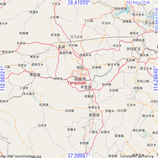
Yangquan GPS coordinates[2]
37° 51' 27" North, 113° 33' 47.988" East
| Map corner | latitude | longitude |
|---|---|---|
| Upper-left | 38.41055°, | 112.86021° |
| Center: | 37.8575°, | 113.56333° |
| Lower-right: | 37.30027°, | 114.26646° |
| Map W x H: | 123.5×123.5 km | = 76.7×76.7mi |
| max Lat: | 53.31946° ⇑19.3% North |
| Yangquan: | 37.8575° |
| min Lat: | ⇓80.7% South 18.22056° |
| min Long | Yangquan | max Long |
| 75.07348° | 113.56333° | 134.28917° |
| W 46%⇐ | ⇒54% E |
Elevation
Elevation of Yangquan is 722 m = 2369 ft, and this is 237.2 m = 778 ft above average elevation for this country.
| Max E: |
5622 m = 18445 ft | 19.4% |
| Yangquan | 722 m 2369 ft | |
| Avg. | 484.8 m = 1591 ft | |
Min E: |
-3 m = -10 ft | 80.6% |
See also: Yangquan elevation on elevation.city.
Geographical zone
Yangquan is located in North temperate zone (between Tropic of Cancer and the Arctic Circle). Distance of this Northern Tropic circle is 1603.4 km =996.3 mi to South.| Distance of | km | miles | from Yangquan |
|---|---|---|---|
| North Pole | 5797.7 | 3602.5 | to North |
| Arctic Circle | 3191.8 | 1983.3 | to North |
| Tropic Cancer | 1603.4 | 996.3 | to South |
| Equator | 4209.4 | 2615.6 | to South |


Nearby cities:
15 places around Yangquan: (largest is in red/bold)
• Beizheng
50.5 km =31.4 mi,  63°
63°
• Chaoyang
36.7 km =22.8 mi,  278°
278°
• Fengshan
47.5 km =29.5 mi, 63°
• Guanshan
6.2 km =3.9 mi,  151°
151°
• Hengbei
49.1 km =30.5 mi, 62°
• Jiazhuang
49.6 km =30.8 mi, 57°
• Leping
28.4 km =17.6 mi,  161°
161°
• Nanxing
56 km =34.8 mi,  49°
49°
• Tianchang
42.6 km =26.5 mi,  68°
68°
• Weizhou
58.4 km =36.3 mi, 61°
• Xiaozuo
49.2 km =30.6 mi, 53°
• Xiushui
31.4 km =19.5 mi,  330°
330°
• Yijing
4.2 km =2.6 mi,  125°
125°
• Yinying
8.8 km =5.5 mi,  356°
356°
• Yixing
57.8 km =35.9 mi,  182°
182°
Sources, notices
• [Note1] Compared only with cities in China existing in our database
• [Src1] Map data: © OpenStreetMap contributors (CC-BY-SA)
• [Src2] Other city data from geonames.org with taken over terms of usage.
• [Src3] Geographical zone / Annual Mean Temperature by Robert A. Rohde @ Wikipedia
