Xiashe geodata
Xiashe (Shanxi) is a seat of a fourth-order administrative division; located in China in Asia/Shanghai (GMT+8) time zone. In our database, there are 1268 cities with bigger population. Compared to other cities in China, 84.7% of cities are located further ↓South; 55.6% of cities are located further →East and 86.1% of cities have lower elevation than Xiashe. Note1


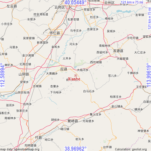
Xiashe GPS coordinates[2]
39° 30' 51.012" North, 113° 17' 35.016" East
| Map corner | latitude | longitude |
|---|---|---|
| Upper-left | 40.05449°, | 112.58994° |
| Center: | 39.51417°, | 113.29306° |
| Lower-right: | 38.96962°, | 113.99619° |
| Map W x H: | 120.6×120.6 km | = 74.9×74.9mi |
| max Lat: | 53.31946° ⇑15.3% North |
| Xiashe: | 39.51417° |
| min Lat: | ⇓84.7% South 18.22056° |
| min Long | Xiashe | max Long |
| 75.07348° | 113.29306° | 134.28917° |
| W 44.4%⇐ | ⇒55.6% E |
Elevation
Elevation of Xiashe is 1048 m = 3438 ft, and this is 563.2 m = 1848 ft above average elevation for this country.
| Max E: |
5622 m = 18445 ft | 13.9% |
| Xiashe | 1048 m 3438 ft | |
| Avg. | 484.8 m = 1591 ft | |
Min E: |
-3 m = -10 ft | 86.1% |
See also: China elevation on elevation.city.
Geographical zone
Xiashe is located in North temperate zone (between Tropic of Cancer and the Arctic Circle). Distance of this Northern Tropic circle is 1787.6 km =1110.8 mi to South.| Distance of | km | miles | from Xiashe |
|---|---|---|---|
| North Pole | 5613.5 | 3488.1 | to North |
| Arctic Circle | 3007.6 | 1868.8 | to North |
| Tropic Cancer | 1787.6 | 1110.8 | to South |
| Equator | 4393.6 | 2730.1 | to South |


Nearby cities:
15 places around Xiashe: (largest is in red/bold)
• Beicaoshan
9.8 km =6.1 mi,  237°
237°
• Dahuangwei
19.1 km =11.9 mi,  275°
275°
• Dalinhe
7.4 km =4.6 mi,  51°
51°
• Hetou
25.4 km =15.8 mi,  356°
356°
• Nanhezhong
4.4 km =2.7 mi,  223°
223°
• Nanquan
14.4 km =8.9 mi, 223°
• Qingshuihe
28 km =17.4 mi,  325°
325°
• Tuofeng
17.6 km =10.9 mi, 49°
• Xiamayu
20.6 km =12.8 mi,  230°
230°
• Xifangcheng
19.5 km =12.1 mi,  55°
55°
• Xinpeicun
23.3 km =14.5 mi, 60°
• Yijing
15.5 km =9.6 mi, 334°
• Yingxian
10.5 km =6.5 mi,  298°
298°
• Zangzhai
20 km =12.4 mi,  309°
309°
• Zhenziliang
6.6 km =4.1 mi,  345°
345°
Sources, notices
• [Note1] Compared only with cities in China existing in our database
• [Src1] Map data: © OpenStreetMap contributors (CC-BY-SA)
• [Src2] Other city data from geonames.org with taken over terms of usage.
• [Src3] Geographical zone / Annual Mean Temperature by Robert A. Rohde @ Wikipedia
