Dalinhe geodata
Dalinhe (Shanxi) is a seat of a fourth-order administrative division; located in China in Asia/Shanghai (GMT+8) time zone. In our database, there are 1268 cities with bigger population. Compared to other cities in China, 84.8% of cities are located further ↓South; 55.2% of cities are located further →East and 85.8% of cities have lower elevation than Dalinhe. Note1


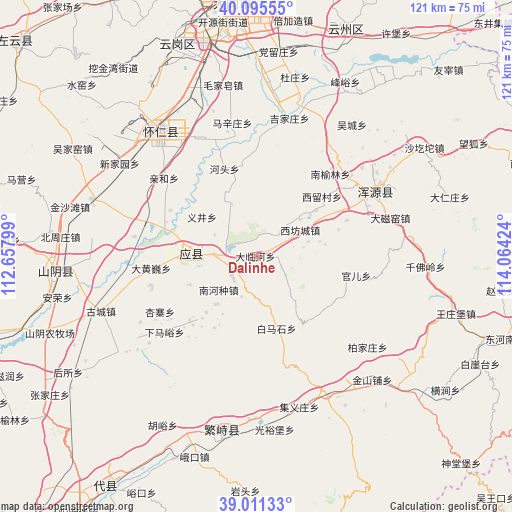
Dalinhe GPS coordinates[2]
39° 33' 20.016" North, 113° 21' 39.996" East
| Map corner | latitude | longitude |
|---|---|---|
| Upper-left | 40.09555°, | 112.65799° |
| Center: | 39.55556°, | 113.36111° |
| Lower-right: | 39.01133°, | 114.06424° |
| Map W x H: | 120.6×120.6 km | = 74.9×74.9mi |
| max Lat: | 53.31946° ⇑15.2% North |
| Dalinhe: | 39.55556° |
| min Lat: | ⇓84.8% South 18.22056° |
| min Long | Dalinhe | max Long |
| 75.07348° | 113.36111° | 134.28917° |
| W 44.8%⇐ | ⇒55.2% E |
Elevation
Elevation of Dalinhe is 1036 m = 3399 ft, and this is 551.2 m = 1808 ft above average elevation for this country.
| Max E: |
5622 m = 18445 ft | 14.2% |
| Dalinhe | 1036 m 3399 ft | |
| Avg. | 484.8 m = 1591 ft | |
Min E: |
-3 m = -10 ft | 85.8% |
See also: China elevation on elevation.city.
Geographical zone
Dalinhe is located in North temperate zone (between Tropic of Cancer and the Arctic Circle). Distance of this Northern Tropic circle is 1792.2 km =1113.6 mi to South.| Distance of | km | miles | from Dalinhe |
|---|---|---|---|
| North Pole | 5608.9 | 3485.2 | to North |
| Arctic Circle | 3003 | 1866 | to North |
| Tropic Cancer | 1792.2 | 1113.6 | to South |
| Equator | 4398.2 | 2732.9 | to South |


Nearby cities:
15 places around Dalinhe: (largest is in red/bold)
• Beicaoshan
17.2 km =10.7 mi,  234°
234°
• Dahuangwei
24.9 km =15.5 mi,  263°
263°
• Guan’er
23.9 km =14.9 mi,  100°
100°
• Hetou
22 km =13.7 mi,  340°
340°
• Nanhezhong
11.8 km =7.3 mi, 228°
• Nanquan
21.8 km =13.5 mi, 226°
• Tuofeng
10.2 km =6.3 mi,  47°
47°
• Xiashe
7.4 km =4.6 mi, 231°
• Xifangcheng
12.1 km =7.5 mi,  58°
58°
• Xiliu
20.9 km =13 mi, 47°
• Xinpeicun
16 km =9.9 mi, 64°
• Yijing
15.7 km =9.8 mi,  306°
306°
• Yingxian
15.1 km =9.4 mi,  271°
271°
• Zangzhai
22.7 km =14.1 mi,  291°
291°
• Zhenziliang
7.6 km =4.7 mi,  283°
283°
Sources, notices
• [Note1] Compared only with cities in China existing in our database
• [Src1] Map data: © OpenStreetMap contributors (CC-BY-SA)
• [Src2] Other city data from geonames.org with taken over terms of usage.
• [Src3] Geographical zone / Annual Mean Temperature by Robert A. Rohde @ Wikipedia
