Xiaoxita geodata
Xiaoxita (Hubei) is a seat of a third-order administrative division; located in China in Asia/Shanghai (GMT+8) time zone. In our database, there are 1268 cities with bigger population. Compared to other cities in China, 52.7% of cities are located further ↓South; 65.8% of cities are located further →East and 64.5% of cities have higher elevation than Xiaoxita. Note1


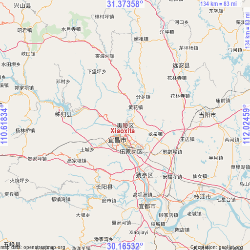
Xiaoxita GPS coordinates[2]
30° 46' 16.86" North, 111° 19' 17.256" East
| Map corner | latitude | longitude |
|---|---|---|
| Upper-left | 31.37358°, | 110.61834° |
| Center: | 30.77135°, | 111.32146° |
| Lower-right: | 30.16532°, | 112.02459° |
| Map W x H: | 134.3×134.3 km | = 83.5×83.5mi |
| max Lat: | 53.31946° ⇑47.3% North |
| Xiaoxita: | 30.77135° |
| min Lat: | ⇓52.7% South 18.22056° |
| min Long | Xiaoxita | max Long |
| 75.07348° | 111.32146° | 134.28917° |
| W 34.2%⇐ | ⇒65.8% E |
Elevation
Elevation of Xiaoxita is 75 m = 246 ft, and this is 409.8 m = 1344 ft below average elevation for this country.
| Max E: |
5622 m = 18445 ft | 64.5% |
| Avg. | 484.8 m = 1591 ft | |
| Xiaoxita | 75 m = 246 ft | |
Min E: |
-3 m = -10 ft | 35.5% |
See also: China elevation on elevation.city.
Geographical zone
Xiaoxita is located in North temperate zone (between Tropic of Cancer and the Arctic Circle). Distance of this Northern Tropic circle is 815.5 km =506.7 mi to South.| Distance of | km | miles | from Xiaoxita |
|---|---|---|---|
| North Pole | 6585.6 | 4092.1 | to North |
| Arctic Circle | 3979.7 | 2472.9 | to North |
| Tropic Cancer | 815.5 | 506.7 | to South |
| Equator | 3421.5 | 2126 | to South |


Nearby cities:
15 places around Xiaoxita: (largest is in red/bold)
• Aijia
16.6 km =10.3 mi,  171°
171°
• Dianjun
9.7 km =6 mi,  217°
217°
• Fenxiang
18.2 km =11.3 mi,  30°
30°
• Huanghua
11.2 km =7 mi, 28°
• Huya
23.4 km =14.5 mi,  162°
162°
• Letianxi
26.3 km =16.3 mi,  294°
294°
• Lianpeng
13.9 km =8.6 mi,  201°
201°
• Longquan
16.7 km =10.4 mi,  105°
105°
• Qiaobian
16.3 km =10.1 mi,  232°
232°
• Tucheng
24.2 km =15 mi,  238°
238°
• Wujia
14.1 km =8.8 mi, 169°
• Xiling
7.1 km =4.4 mi,  210°
210°
• Yaowan
6.7 km =4.2 mi, 197°
• Yaqueling
28.9 km =18 mi,  118°
118°
• Yichang
7.2 km =4.5 mi, 209°
Sources, notices
• [Note1] Compared only with cities in China existing in our database
• [Src1] Map data: © OpenStreetMap contributors (CC-BY-SA)
• [Src2] Other city data from geonames.org with taken over terms of usage.
• [Src3] Geographical zone / Annual Mean Temperature by Robert A. Rohde @ Wikipedia
