Letianxi geodata
Letianxi (Hubei) is a seat of a fourth-order administrative division; located in China in Asia/Shanghai (GMT+8) time zone. In our database, there are 1268 cities with bigger population. Compared to other cities in China, 53.6% of cities are located further ↓South; 66.8% of cities are located further →East and 59.4% of cities have higher elevation than Letianxi. Note1


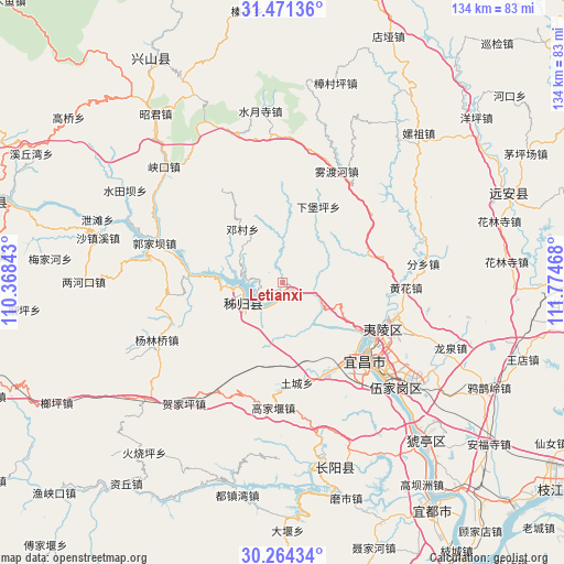
Letianxi GPS coordinates[2]
30° 52' 11.1" North, 111° 4' 17.58" East
| Map corner | latitude | longitude |
|---|---|---|
| Upper-left | 31.47136°, | 110.36843° |
| Center: | 30.86975°, | 111.07155° |
| Lower-right: | 30.26434°, | 111.77468° |
| Map W x H: | 134.2×134.2 km | = 83.4×83.4mi |
| max Lat: | 53.31946° ⇑46.4% North |
| Letianxi: | 30.86975° |
| min Lat: | ⇓53.6% South 18.22056° |
| min Long | Letianxi | max Long |
| 75.07348° | 111.07155° | 134.28917° |
| W 33.2%⇐ | ⇒66.8% E |
Elevation
Elevation of Letianxi is 102 m = 335 ft, and this is 382.8 m = 1256 ft below average elevation for this country.
| Max E: |
5622 m = 18445 ft | 59.4% |
| Avg. | 484.8 m = 1591 ft | |
| Letianxi | 102 m = 335 ft | |
Min E: |
-3 m = -10 ft | 40.6% |
See also: China elevation on elevation.city.
Geographical zone
Letianxi is located in North temperate zone (between Tropic of Cancer and the Arctic Circle). Distance of this Northern Tropic circle is 826.5 km =513.6 mi to South.| Distance of | km | miles | from Letianxi |
|---|---|---|---|
| North Pole | 6574.7 | 4085.3 | to North |
| Arctic Circle | 3968.8 | 2466.1 | to North |
| Tropic Cancer | 826.5 | 513.6 | to South |
| Equator | 3432.4 | 2132.8 | to South |


Nearby cities:
15 places around Letianxi: (largest is in red/bold)
• Dianjun
26 km =16.2 mi,  136°
136°
• Gaojiayan
29.1 km =18.1 mi,  182°
182°
• Huanghua
29.3 km =18.2 mi,  92°
92°
• Maoping
10 km =6.2 mi,  243°
243°
• Qiaobian
23.6 km =14.7 mi,  152°
152°
• Quyuan
24.3 km =15.1 mi,  287°
287°
• Sandouping
8.4 km =5.2 mi,  219°
219°
• Taipingxi
10.3 km =6.4 mi,  274°
274°
• Tucheng
24 km =14.9 mi,  172°
172°
• Xiabaoping
20 km =12.4 mi,  24°
24°
• Xiaoxita
26.3 km =16.3 mi,  114°
114°
• Xiling
26.5 km =16.5 mi,  130°
130°
• Yaowan
27.9 km =17.3 mi, 128°
• Yichang
26.7 km =16.6 mi, 130°
• Zhouping
28 km =17.4 mi,  263°
263°
Sources, notices
• [Note1] Compared only with cities in China existing in our database
• [Src1] Map data: © OpenStreetMap contributors (CC-BY-SA)
• [Src2] Other city data from geonames.org with taken over terms of usage.
• [Src3] Geographical zone / Annual Mean Temperature by Robert A. Rohde @ Wikipedia
