Xiahe geodata
Xiahe (Fujian) is a seat of a fourth-order administrative division; located in China in Asia/Shanghai (GMT+8) time zone. In our database, there are 1268 cities with bigger population. Compared to other cities in China, 90.4% of cities are located further ↑North; 67.6% of cities are located further ←West and 72.3% of cities have higher elevation than Xiahe. Note1


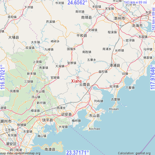
Xiahe GPS coordinates[2]
24° 0' 56.016" North, 117° 16' 23.988" East
| Map corner | latitude | longitude |
|---|---|---|
| Upper-left | 24.6562°, | 116.57021° |
| Center: | 24.01556°, | 117.27333° |
| Lower-right: | 23.37171°, | 117.97646° |
| Map W x H: | 142.8×142.8 km | = 88.7×88.7mi |
| max Lat: | 53.31946° ⇑90.4% North |
| Xiahe: | 24.01556° |
| min Lat: | ⇓9.6% South 18.22056° |
| min Long | Xiahe | max Long |
| 75.07348° | 117.27333° | 134.28917° |
| W 67.6%⇐ | ⇒32.4% E |
Elevation
Elevation of Xiahe is 44 m = 144 ft, and this is 440.8 m = 1446 ft below average elevation for this country.
| Max E: |
5622 m = 18445 ft | 72.3% |
| Avg. | 484.8 m = 1591 ft | |
| Xiahe | 44 m = 144 ft | |
Min E: |
-3 m = -10 ft | 27.7% |
See also: China elevation on elevation.city.
Geographical zone
Xiahe is located in North temperate zone (between Tropic of Cancer and the Arctic Circle). Distance of this Northern Tropic circle is 64.4 km =40 mi to South.| Distance of | km | miles | from Xiahe |
|---|---|---|---|
| North Pole | 7336.8 | 4558.9 | to North |
| Arctic Circle | 4730.9 | 2939.6 | to North |
| Tropic Cancer | 64.4 | 40 | to South |
| Equator | 2670.3 | 1659.2 | to South |


Nearby cities:
15 places around Xiahe: (largest is in red/bold)
• Chendai
27.8 km =17.3 mi,  152°
152°
• Dongkeng
13.3 km =8.3 mi,  123°
123°
• Dongpu
21.5 km =13.4 mi,  227°
227°
• Houxixi
31.5 km =19.6 mi,  209°
209°
• Jingbaoshan
29.2 km =18.1 mi,  217°
217°
• Lieyu
28.7 km =17.8 mi,  137°
137°
• Lushikeng
28.4 km =17.6 mi,  183°
183°
• Meizhou
23.4 km =14.5 mi,  169°
169°
• Sidu
25.8 km =16 mi, 179°
• Taiping
29.2 km =18.1 mi,  244°
244°
• Xiage
26.7 km =16.6 mi,  264°
264°
• Xiuzhuan
32.9 km =20.4 mi,  287°
287°
• Yunling
9.4 km =5.8 mi, 137°
• Zhaizipu
6.6 km =4.1 mi,  189°
189°
• Zhengyang
34.3 km =21.3 mi,  103°
103°
Sources, notices
• [Note1] Compared only with cities in China existing in our database
• [Src1] Map data: © OpenStreetMap contributors (CC-BY-SA)
• [Src2] Other city data from geonames.org with taken over terms of usage.
• [Src3] Geographical zone / Annual Mean Temperature by Robert A. Rohde @ Wikipedia
