Zhaizipu geodata
Zhaizipu (Fujian) is a seat of a fourth-order administrative division; located in China in Asia/Shanghai (GMT+8) time zone. In our database, there are 1268 cities with bigger population. Compared to other cities in China, 90.6% of cities are located further ↑North; 67.6% of cities are located further ←West and 77.7% of cities have higher elevation than Zhaizipu. Note1


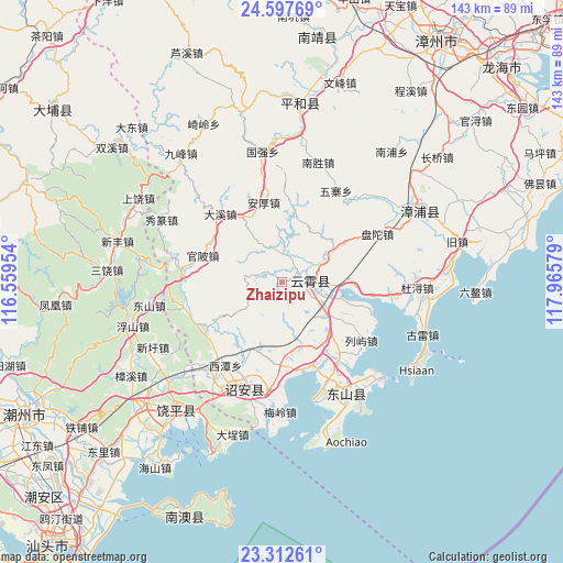
Zhaizipu GPS coordinates[2]
23° 57' 24.3" North, 117° 15' 45.576" East
| Map corner | latitude | longitude |
|---|---|---|
| Upper-left | 24.59769°, | 116.55954° |
| Center: | 23.95675°, | 117.26266° |
| Lower-right: | 23.31261°, | 117.96579° |
| Map W x H: | 142.9×142.9 km | = 88.8×88.8mi |
| max Lat: | 53.31946° ⇑90.6% North |
| Zhaizipu: | 23.95675° |
| min Lat: | ⇓9.4% South 18.22056° |
| min Long | Zhaizipu | max Long |
| 75.07348° | 117.26266° | 134.28917° |
| W 67.6%⇐ | ⇒32.4% E |
Elevation
Elevation of Zhaizipu is 31 m = 102 ft, and this is 453.8 m = 1489 ft below average elevation for this country.
| Max E: |
5622 m = 18445 ft | 77.7% |
| Avg. | 484.8 m = 1591 ft | |
| Zhaizipu | 31 m = 102 ft | |
Min E: |
-3 m = -10 ft | 22.3% |
See also: China elevation on elevation.city.
Geographical zone
Zhaizipu is located in North temperate zone (between Tropic of Cancer and the Arctic Circle). Distance of this Northern Tropic circle is 57.8 km =35.9 mi to South.| Distance of | km | miles | from Zhaizipu |
|---|---|---|---|
| North Pole | 7343.3 | 4562.9 | to North |
| Arctic Circle | 4737.4 | 2943.7 | to North |
| Tropic Cancer | 57.8 | 35.9 | to South |
| Equator | 2663.7 | 1655.1 | to South |


Nearby cities:
15 places around Zhaizipu: (largest is in red/bold)
• Chendai
22.9 km =14.2 mi,  141°
141°
• Dongkeng
12.2 km =7.6 mi,  93°
93°
• Dongpu
16.8 km =10.4 mi,  242°
242°
• Houxixi
25.4 km =15.8 mi,  214°
214°
• Jingbaoshan
23.6 km =14.7 mi,  225°
225°
• Lieyu
25.1 km =15.6 mi,  126°
126°
• Lushikeng
21.8 km =13.5 mi,  181°
181°
• Meizhou
17.3 km =10.7 mi,  162°
162°
• Nanzhao
27.9 km =17.3 mi,  199°
199°
• Shenqiao
28.1 km =17.5 mi, 206°
• Sidu
19.3 km =12 mi, 176°
• Taiping
25.9 km =16.1 mi,  256°
256°
• Xiage
25.9 km =16.1 mi,  279°
279°
• Xiahe
6.6 km =4.1 mi,  9°
9°
• Yunling
7.5 km =4.7 mi, 92°
Sources, notices
• [Note1] Compared only with cities in China existing in our database
• [Src1] Map data: © OpenStreetMap contributors (CC-BY-SA)
• [Src2] Other city data from geonames.org with taken over terms of usage.
• [Src3] Geographical zone / Annual Mean Temperature by Robert A. Rohde @ Wikipedia
