Wangtai geodata
Wangtai (Fujian) is a seat of a fourth-order administrative division; located in China in Asia/Shanghai (GMT+8) time zone. In our database, there are 1268 cities with bigger population. Compared to other cities in China, 79.9% of cities are located further ↑North; 70.5% of cities are located further ←West and 59% of cities have higher elevation than Wangtai. Note1


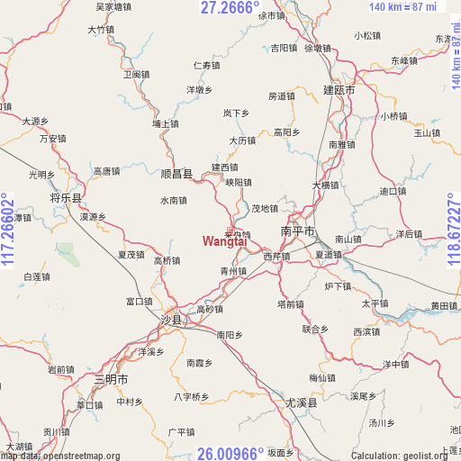
Wangtai GPS coordinates[2]
26° 38' 23.496" North, 117° 58' 8.904" East
| Map corner | latitude | longitude |
|---|---|---|
| Upper-left | 27.2666°, | 117.26602° |
| Center: | 26.63986°, | 117.96914° |
| Lower-right: | 26.00966°, | 118.67227° |
| Map W x H: | 139.8×139.8 km | = 86.9×86.9mi |
| max Lat: | 53.31946° ⇑79.9% North |
| Wangtai: | 26.63986° |
| min Lat: | ⇓20.1% South 18.22056° |
| min Long | Wangtai | max Long |
| 75.07348° | 117.96914° | 134.28917° |
| W 70.5%⇐ | ⇒29.5% E |
Elevation
Elevation of Wangtai is 104 m = 341 ft, and this is 380.8 m = 1249 ft below average elevation for this country.
| Max E: |
5622 m = 18445 ft | 59% |
| Avg. | 484.8 m = 1591 ft | |
| Wangtai | 104 m = 341 ft | |
Min E: |
-3 m = -10 ft | 41% |
See also: China elevation on elevation.city.
Geographical zone
Wangtai is located in North temperate zone (between Tropic of Cancer and the Arctic Circle). Distance of this Northern Tropic circle is 356.2 km =221.3 mi to South.| Distance of | km | miles | from Wangtai |
|---|---|---|---|
| North Pole | 7045 | 4377.6 | to North |
| Arctic Circle | 4439.1 | 2758.3 | to North |
| Tropic Cancer | 356.2 | 221.3 | to South |
| Equator | 2962.1 | 1840.6 | to South |


Nearby cities:
15 places around Wangtai: (largest is in red/bold)
• Gaoqiao
21.2 km =13.2 mi,  245°
245°
• Gaosha
24.4 km =15.2 mi,  194°
194°
• Jianxi
19.5 km =12.1 mi,  354°
354°
• Jihui
24.5 km =15.2 mi,  343°
343°
• Laizhou
2.1 km =1.3 mi,  130°
130°
• Lishu
25.7 km =16 mi,  258°
258°
• Mangdang
19.3 km =12 mi,  74°
74°
• Maodi
12.5 km =7.8 mi,  56°
56°
• Nanping
20.3 km =12.6 mi,  88°
88°
• Qingzhou
12.1 km =7.5 mi,  176°
176°
• Shuinan
19.7 km =12.2 mi,  298°
298°
• Xiayang
15.1 km =9.4 mi,  9°
9°
• Xiqin
15.9 km =9.9 mi,  118°
118°
• Yangkou
19.2 km =11.9 mi, 338°
• Zhengfang
27.3 km =17 mi,  287°
287°
Sources, notices
• [Note1] Compared only with cities in China existing in our database
• [Src1] Map data: © OpenStreetMap contributors (CC-BY-SA)
• [Src2] Other city data from geonames.org with taken over terms of usage.
• [Src3] Geographical zone / Annual Mean Temperature by Robert A. Rohde @ Wikipedia
