Taipingguan geodata
Taipingguan (Jiangxi) is a seat of a fourth-order administrative division; located in China in Asia/Shanghai (GMT+8) time zone. In our database, there are 1268 cities with bigger population. Compared to other cities in China, 56.8% of cities are located further ↑North; 62.6% of cities are located further ←West and 80.8% of cities have higher elevation than Taipingguan. Note1


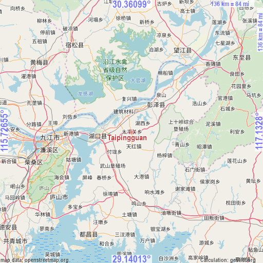
Taipingguan GPS coordinates[2]
29° 45' 8.712" North, 116° 25' 46.812" East
| Map corner | latitude | longitude |
|---|---|---|
| Upper-left | 30.36099°, | 115.72655° |
| Center: | 29.75242°, | 116.42967° |
| Lower-right: | 29.14013°, | 117.1328° |
| Map W x H: | 135.7×135.7 km | = 84.3×84.3mi |
| max Lat: | 53.31946° ⇑56.8% North |
| Taipingguan: | 29.75242° |
| min Lat: | ⇓43.2% South 18.22056° |
| min Long | Taipingguan | max Long |
| 75.07348° | 116.42967° | 134.28917° |
| W 62.6%⇐ | ⇒37.4% E |
Elevation
Elevation of Taipingguan is 25 m = 82 ft, and this is 459.8 m = 1509 ft below average elevation for this country.
| Max E: |
5622 m = 18445 ft | 80.8% |
| Avg. | 484.8 m = 1591 ft | |
| Taipingguan | 25 m = 82 ft | |
Min E: |
-3 m = -10 ft | 19.2% |
See also: China elevation on elevation.city.
Geographical zone
Taipingguan is located in North temperate zone (between Tropic of Cancer and the Arctic Circle). Distance of this Northern Tropic circle is 702.2 km =436.3 mi to South.| Distance of | km | miles | from Taipingguan |
|---|---|---|---|
| North Pole | 6698.9 | 4162.5 | to North |
| Arctic Circle | 4093 | 2543.3 | to North |
| Tropic Cancer | 702.2 | 436.3 | to South |
| Equator | 3308.2 | 2055.6 | to South |


Nearby cities:
15 places around Taipingguan: (largest is in red/bold)
• Dalong
4.5 km =2.8 mi,  258°
258°
• Dingshan
8.1 km =5 mi,  346°
346°
• Fulong
13.6 km =8.5 mi,  220°
220°
• Furongdun
13.4 km =8.3 mi,  27°
27°
• Fuxing
17.1 km =10.6 mi, 354°
• Huangcun
10.8 km =6.7 mi,  280°
280°
• Huangling
14.1 km =8.8 mi,  68°
68°
• Huikou
19.2 km =11.9 mi,  292°
292°
• Liusi
7.8 km =4.8 mi,  300°
300°
• Maying
13.6 km =8.5 mi, 256°
• Shuangzhong
19.9 km =12.4 mi,  266°
266°
• Tianhong
7.6 km =4.7 mi,  173°
173°
• Wenqiao
16.2 km =10.1 mi,  231°
231°
• Zhangqing
10.3 km =6.4 mi,  246°
246°
• Zhoutou
16.4 km =10.2 mi,  319°
319°
Sources, notices
• [Note1] Compared only with cities in China existing in our database
• [Src1] Map data: © OpenStreetMap contributors (CC-BY-SA)
• [Src2] Other city data from geonames.org with taken over terms of usage.
• [Src3] Geographical zone / Annual Mean Temperature by Robert A. Rohde @ Wikipedia
