Zhangqing geodata
Zhangqing (Jiangxi) is a seat of a fourth-order administrative division; located in China in Asia/Shanghai (GMT+8) time zone. In our database, there are 1268 cities with bigger population. Compared to other cities in China, 57.3% of cities are located further ↑North; 62% of cities are located further ←West and 77.2% of cities have higher elevation than Zhangqing. Note1


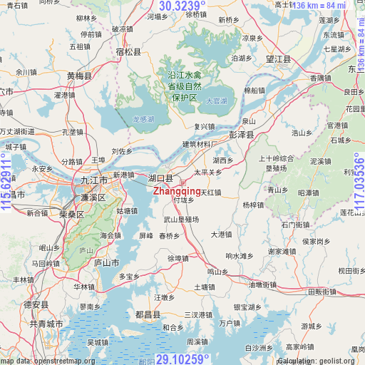
Zhangqing GPS coordinates[2]
29° 42' 54.36" North, 116° 19' 56.028" East
| Map corner | latitude | longitude |
|---|---|---|
| Upper-left | 30.3239°, | 115.62911° |
| Center: | 29.7151°, | 116.33223° |
| Lower-right: | 29.10259°, | 117.03536° |
| Map W x H: | 135.8×135.8 km | = 84.4×84.4mi |
| max Lat: | 53.31946° ⇑57.3% North |
| Zhangqing: | 29.7151° |
| min Lat: | ⇓42.7% South 18.22056° |
| min Long | Zhangqing | max Long |
| 75.07348° | 116.33223° | 134.28917° |
| W 62%⇐ | ⇒38% E |
Elevation
Elevation of Zhangqing is 32 m = 105 ft, and this is 452.8 m = 1486 ft below average elevation for this country.
| Max E: |
5622 m = 18445 ft | 77.2% |
| Avg. | 484.8 m = 1591 ft | |
| Zhangqing | 32 m = 105 ft | |
Min E: |
-3 m = -10 ft | 22.8% |
See also: China elevation on elevation.city.
Geographical zone
Zhangqing is located in North temperate zone (between Tropic of Cancer and the Arctic Circle). Distance of this Northern Tropic circle is 698.1 km =433.8 mi to South.| Distance of | km | miles | from Zhangqing |
|---|---|---|---|
| North Pole | 6703.1 | 4165.1 | to North |
| Arctic Circle | 4097.2 | 2545.9 | to North |
| Tropic Cancer | 698.1 | 433.8 | to South |
| Equator | 3304 | 2053 | to South |


Nearby cities:
15 places around Zhangqing: (largest is in red/bold)
• Chengshan
14.6 km =9.1 mi,  209°
209°
• Dalong
6 km =3.7 mi,  57°
57°
• Dingshan
14.2 km =8.8 mi,  31°
31°
• Fulong
6.1 km =3.8 mi,  175°
175°
• Huangcun
6.3 km =3.9 mi,  349°
349°
• Huikou
14.2 km =8.8 mi,  323°
323°
• Liufang
20.3 km =12.6 mi,  198°
198°
• Liusi
8.5 km =5.3 mi,  18°
18°
• Maying
4 km =2.5 mi,  285°
285°
• Shuangzhong
10.9 km =6.8 mi, 286°
• Taipingguan
10.3 km =6.4 mi,  66°
66°
• Tianhong
10.8 km =6.7 mi,  108°
108°
• Wenqiao
6.8 km =4.2 mi, 208°
• Wushan
14.6 km =9.1 mi, 180°
• Zhoutou
16.6 km =10.3 mi,  355°
355°
Sources, notices
• [Note1] Compared only with cities in China existing in our database
• [Src1] Map data: © OpenStreetMap contributors (CC-BY-SA)
• [Src2] Other city data from geonames.org with taken over terms of usage.
• [Src3] Geographical zone / Annual Mean Temperature by Robert A. Rohde @ Wikipedia
