Qiandong geodata
Qiandong (Guangdong) is a seat of a fourth-order administrative division; located in China in Asia/Shanghai (GMT+8) time zone. In our database, there are 1268 cities with bigger population. Compared to other cities in China, 91.4% of cities are located further ↑North; 65.5% of cities are located further ←West and 89.9% of cities have higher elevation than Qiandong. Note1


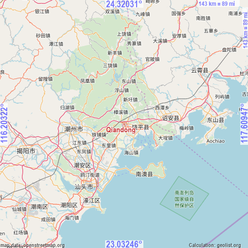
Qiandong GPS coordinates[2]
23° 40' 40.692" North, 116° 54' 22.824" East
| Map corner | latitude | longitude |
|---|---|---|
| Upper-left | 24.32031°, | 116.20322° |
| Center: | 23.67797°, | 116.90634° |
| Lower-right: | 23.03246°, | 117.60947° |
| Map W x H: | 143.2×143.2 km | = 89×89mi |
| max Lat: | 53.31946° ⇑91.4% North |
| Qiandong: | 23.67797° |
| min Lat: | ⇓8.6% South 18.22056° |
| min Long | Qiandong | max Long |
| 75.07348° | 116.90634° | 134.28917° |
| W 65.5%⇐ | ⇒34.5% E |
Elevation
Elevation of Qiandong is 10 m = 33 ft, and this is 474.8 m = 1558 ft below average elevation for this country.
| Max E: |
5622 m = 18445 ft | 89.9% |
| Avg. | 484.8 m = 1591 ft | |
| Qiandong | 10 m = 33 ft | |
Min E: |
-3 m = -10 ft | 10.1% |
See also: China elevation on elevation.city.
Geographical zone
Qiandong is located in North temperate zone (between Tropic of Cancer and the Arctic Circle). Distance of this Northern Tropic circle is 26.8 km =16.7 mi to South.| Distance of | km | miles | from Qiandong |
|---|---|---|---|
| North Pole | 7374.3 | 4582.2 | to North |
| Arctic Circle | 4768.4 | 2962.9 | to North |
| Tropic Cancer | 26.8 | 16.7 | to South |
| Equator | 2632.7 | 1635.9 | to South |


Nearby cities:
15 places around Qiandong: (largest is in red/bold)
• Dongli
16.1 km =10 mi,  216°
216°
• Fubin
19.2 km =11.9 mi,  344°
344°
• Fushan
19.7 km =12.2 mi,  353°
353°
• Gaotang
6.6 km =4.1 mi,  37°
37°
• Guantang
19.3 km =12 mi,  251°
251°
• Haishan
17.3 km =10.7 mi,  163°
163°
• Huanggang
9.5 km =5.9 mi,  90°
90°
• Jingzhou
5.6 km =3.5 mi,  152°
152°
• Lianhua
15.6 km =9.7 mi, 223°
• Lianrao
9.9 km =6.2 mi,  49°
49°
• Tiepu
17 km =10.6 mi, 245°
• Xinan
17.7 km =11 mi,  214°
214°
• Xinxu
15.7 km =9.8 mi,  12°
12°
• Yanhong
10.4 km =6.5 mi, 208°
• Zhangxi
7.6 km =4.7 mi, 344°
Sources, notices
• [Note1] Compared only with cities in China existing in our database
• [Src1] Map data: © OpenStreetMap contributors (CC-BY-SA)
• [Src2] Other city data from geonames.org with taken over terms of usage.
• [Src3] Geographical zone / Annual Mean Temperature by Robert A. Rohde @ Wikipedia
