Ningzhou geodata
Ningzhou (Yunnan) is a seat of a third-order administrative division; located in China in Asia/Shanghai (GMT+8) time zone. In our database, there are 1268 cities with bigger population. Compared to other cities in China, 89.7% of cities are located further ↑North; 91.7% of cities are located further →East and 92.3% of cities have lower elevation than Ningzhou. Note1


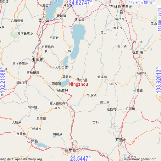
Ningzhou GPS coordinates[2]
24° 11' 15.72" North, 102° 55' 1.2" East
| Map corner | latitude | longitude |
|---|---|---|
| Upper-left | 24.82747°, | 102.21388° |
| Center: | 24.1877°, | 102.917° |
| Lower-right: | 23.5447°, | 103.62013° |
| Map W x H: | 142.6×142.6 km | = 88.6×88.6mi |
| max Lat: | 53.31946° ⇑89.7% North |
| Ningzhou: | 24.1877° |
| min Lat: | ⇓10.3% South 18.22056° |
| min Long | Ningzhou | max Long |
| 75.07348° | 102.917° | 134.28917° |
| W 8.3%⇐ | ⇒91.7% E |
Elevation
Elevation of Ningzhou is 1620 m = 5315 ft, and this is 1135.2 m = 3724 ft above average elevation for this country.
| Max E: |
5622 m = 18445 ft | 7.7% |
| Ningzhou | 1620 m 5315 ft | |
| Avg. | 484.8 m = 1591 ft | |
Min E: |
-3 m = -10 ft | 92.3% |
See also: China elevation on elevation.city.
Geographical zone
Ningzhou is located in North temperate zone (between Tropic of Cancer and the Arctic Circle). Distance of this Northern Tropic circle is 83.5 km =51.9 mi to South.| Distance of | km | miles | from Ningzhou |
|---|---|---|---|
| North Pole | 7317.6 | 4546.9 | to North |
| Arctic Circle | 4711.8 | 2927.8 | to North |
| Tropic Cancer | 83.5 | 51.9 | to South |
| Equator | 2689.4 | 1671.1 | to South |


Nearby cities:
15 places around Ningzhou: (largest is in red/bold)
• Baigecun
25.9 km =16.1 mi,  262°
262°
• Dajie
20.7 km =12.9 mi,  305°
305°
• Hexi
27.7 km =17.2 mi, 259°
• Huaxijie
15.9 km =9.9 mi,  141°
141°
• Jiujie
24.8 km =15.4 mi,  250°
250°
• Lishan
21.3 km =13.2 mi,  232°
232°
• Najiaying
18.1 km =11.2 mi,  268°
268°
• Qianwei
25.6 km =15.9 mi, 311°
• Qingnianlu
18.8 km =11.7 mi,  77°
77°
• Sijie
21.6 km =13.4 mi, 263°
• Tonghong
22.8 km =14.2 mi,  42°
42°
• Xiaojiezi
18.3 km =11.4 mi,  342°
342°
• Xiongguan
12.5 km =7.8 mi,  289°
289°
• Xiushan
18 km =11.2 mi,  241°
241°
• Yangguang
13.7 km =8.5 mi, 245°
Sources, notices
• [Note1] Compared only with cities in China existing in our database
• [Src1] Map data: © OpenStreetMap contributors (CC-BY-SA)
• [Src2] Other city data from geonames.org with taken over terms of usage.
• [Src3] Geographical zone / Annual Mean Temperature by Robert A. Rohde @ Wikipedia
