Maoyang geodata
Maoyang (Hainan) is a seat of a fourth-order administrative division; located in China in Asia/Shanghai (GMT+8) time zone. In our database, there are 1268 cities with bigger population. Compared to other cities in China, 99.6% of cities are located further ↑North; 73.6% of cities are located further →East and 64% of cities have lower elevation than Maoyang. Note1


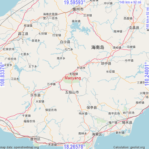
Maoyang GPS coordinates[2]
18° 55' 55.848" North, 109° 32' 12.768" East
| Map corner | latitude | longitude |
|---|---|---|
| Upper-left | 19.59593°, | 108.83376° |
| Center: | 18.93218°, | 109.53688° |
| Lower-right: | 18.26578°, | 110.24001° |
| Map W x H: | 147.9×147.9 km | = 91.9×91.9mi |
| max Lat: | 53.31946° ⇑99.6% North |
| Maoyang: | 18.93218° |
| min Lat: | ⇓0.4% South 18.22056° |
| min Long | Maoyang | max Long |
| 75.07348° | 109.53688° | 134.28917° |
| W 26.4%⇐ | ⇒73.6% E |
Elevation
Elevation of Maoyang is 310 m = 1017 ft, and this is 174.8 m = 573 ft below average elevation for this country.
| Max E: |
5622 m = 18445 ft | 36% |
| Avg. | 484.8 m = 1591 ft | |
| Maoyang | 310 m = 1017 ft | |
Min E: |
-3 m = -10 ft | 64% |
See also: China elevation on elevation.city.
Geographical zone
Maoyang is located in North Torrid zone (between Equator and Tropic of Cancer). Distance of this Northern Tropic circle is 500.9 km =311.2 mi to North.| Distance of | km | miles | from Maoyang |
|---|---|---|---|
| North Pole | 7902 | 4910.1 | to North |
| Arctic Circle | 5296.1 | 3290.8 | to North |
| Tropic Cancer | 500.9 | 311.2 | to North |
| Equator | 2105.1 | 1308 | to South |


Nearby cities:
15 places around Maoyang: (largest is in red/bold)
• Baisha
30.3 km =18.8 mi,  342°
342°
• Changhao
22.5 km =14 mi,  196°
196°
• Chongshan
17.1 km =10.6 mi,  192°
192°
• Fanyang
16.3 km =10.1 mi,  247°
247°
• Hongmao
17.1 km =10.6 mi,  52°
52°
• Maodao
19.2 km =11.9 mi,  229°
229°
• Nankai
21.3 km =13.2 mi,  320°
320°
• Nansheng
23.6 km =14.7 mi,  164°
164°
• Shang’an
31.7 km =19.7 mi,  101°
101°
• Shiyun
9.7 km =6 mi,  43°
43°
• Wanchong
24.9 km =15.5 mi, 248°
• Xishui
31.1 km =19.3 mi,  4°
4°
• Yacha
34.5 km =21.4 mi, 344°
• Yinggen
34 km =21.1 mi,  69°
69°
• Yuanmen
25.8 km =16 mi,  347°
347°
Sources, notices
• [Note1] Compared only with cities in China existing in our database
• [Src1] Map data: © OpenStreetMap contributors (CC-BY-SA)
• [Src2] Other city data from geonames.org with taken over terms of usage.
• [Src3] Geographical zone / Annual Mean Temperature by Robert A. Rohde @ Wikipedia
