Fanyang geodata
Fanyang (Hainan) is a seat of a fourth-order administrative division; located in China in Asia/Shanghai (GMT+8) time zone. In our database, there are 1268 cities with bigger population. Compared to other cities in China, 99.7% of cities are located further ↑North; 74.4% of cities are located further →East and 53.6% of cities have lower elevation than Fanyang. Note1


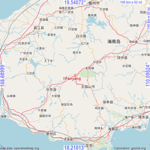
Fanyang GPS coordinates[2]
18° 52' 36.3" North, 109° 23' 35.196" East
| Map corner | latitude | longitude |
|---|---|---|
| Upper-left | 19.54072°, | 108.68999° |
| Center: | 18.87675°, | 109.39311° |
| Lower-right: | 18.21013°, | 110.09624° |
| Map W x H: | 147.9×148 km | = 91.9×92mi |
| max Lat: | 53.31946° ⇑99.7% North |
| Fanyang: | 18.87675° |
| min Lat: | ⇓0.3% South 18.22056° |
| min Long | Fanyang | max Long |
| 75.07348° | 109.39311° | 134.28917° |
| W 25.6%⇐ | ⇒74.4% E |
Elevation
Elevation of Fanyang is 194 m = 636 ft, and this is 290.8 m = 954 ft below average elevation for this country.
| Max E: |
5622 m = 18445 ft | 46.4% |
| Avg. | 484.8 m = 1591 ft | |
| Fanyang | 194 m = 636 ft | |
Min E: |
-3 m = -10 ft | 53.6% |
See also: China elevation on elevation.city.
Geographical zone
Fanyang is located in North Torrid zone (between Equator and Tropic of Cancer). Distance of this Northern Tropic circle is 507 km =315 mi to North.| Distance of | km | miles | from Fanyang |
|---|---|---|---|
| North Pole | 7908.2 | 4913.9 | to North |
| Arctic Circle | 5302.3 | 3294.7 | to North |
| Tropic Cancer | 507 | 315 | to North |
| Equator | 2098.9 | 1304.2 | to South |


Nearby cities:
15 places around Fanyang: (largest is in red/bold)
• Baisha
35.5 km =22.1 mi,  9°
9°
• Baoyou
27.3 km =17 mi,  238°
238°
• Changhao
17.8 km =11.1 mi,  150°
150°
• Chongshan
15.5 km =9.6 mi,  132°
132°
• Da’an
27.9 km =17.3 mi,  223°
223°
• Hongmao
33.1 km =20.6 mi,  59°
59°
• Maodao
6.4 km =4 mi,  175°
175°
• Maoyang
16.3 km =10.1 mi,  67°
67°
• Nankai
22.7 km =14.1 mi,  4°
4°
• Nansheng
27.1 km =16.8 mi, 127°
• Shiyun
25.5 km =15.8 mi, 58°
• Wanchong
8.6 km =5.3 mi,  248°
248°
• Xiangshui
39.1 km =24.3 mi,  143°
143°
• Yuanmen
32.7 km =20.3 mi,  16°
16°
• Zhizhong
31.6 km =19.6 mi,  204°
204°
Sources, notices
• [Note1] Compared only with cities in China existing in our database
• [Src1] Map data: © OpenStreetMap contributors (CC-BY-SA)
• [Src2] Other city data from geonames.org with taken over terms of usage.
• [Src3] Geographical zone / Annual Mean Temperature by Robert A. Rohde @ Wikipedia
