Longgang geodata
Longgang (Shandong) is a seat of a fourth-order administrative division; located in China in Asia/Shanghai (GMT+8) time zone. With population of 60,444 people, there are 725 cities with bigger population in this country. Compared to other cities in China, 80.5% of cities are located further ↓South; 84.1% of cities are located further ←West and 95.9% of cities have higher elevation than Longgang. Note1


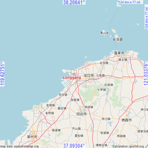
Longgang GPS coordinates[2]
37° 39' 6.516" North, 120° 19' 50.268" East
| Map corner | latitude | longitude |
|---|---|---|
| Upper-left | 38.20641°, | 119.62751° |
| Center: | 37.65181°, | 120.33063° |
| Lower-right: | 37.09304°, | 121.03376° |
| Map W x H: | 123.8×123.8 km | = 76.9×76.9mi |
| max Lat: | 53.31946° ⇑19.5% North |
| Longgang: | 37.65181° |
| min Lat: | ⇓80.5% South 18.22056° |
| min Long | Longgang | max Long |
| 75.07348° | 120.33063° | 134.28917° |
| W 84.1%⇐ | ⇒15.9% E |
Elevation
Elevation of Longgang is 6 m = 20 ft, and this is 478.8 m = 1571 ft below average elevation for this country.
| Max E: |
5622 m = 18445 ft | 95.9% |
| Avg. | 484.8 m = 1591 ft | |
| Longgang | 6 m = 20 ft | |
Min E: |
-3 m = -10 ft | 4.1% |
See also: Longgang elevation on elevation.city.
Geographical zone
Longgang is located in North temperate zone (between Tropic of Cancer and the Arctic Circle). Distance of this Northern Tropic circle is 1580.6 km =982.1 mi to South.| Distance of | km | miles | from Longgang |
|---|---|---|---|
| North Pole | 5820.6 | 3616.8 | to North |
| Arctic Circle | 3214.7 | 1997.5 | to North |
| Tropic Cancer | 1580.6 | 982.1 | to South |
| Equator | 4186.5 | 2601.4 | to South |


Nearby cities:
15 places around Longgang: (largest is in red/bold)
• Beigou
26.8 km =16.7 mi,  69°
69°
• Beima
6.5 km =4 mi,  136°
136°
• Dongjiang
16.2 km =10.1 mi,  100°
100°
• Donglai
16.9 km =10.5 mi,  91°
91°
• Huangshanguan
13 km =8.1 mi,  201°
201°
• Jinling
28.4 km =17.6 mi,  185°
185°
• Langao
22.5 km =14 mi, 92°
• Lutou
12.2 km =7.6 mi,  111°
111°
• Qijia
26.4 km =16.4 mi,  118°
118°
• Xiadingjia
19.2 km =11.9 mi,  131°
131°
• Xinjia
13.6 km =8.5 mi, 87°
• Xinzhuang
19.2 km =11.9 mi,  209°
209°
• Xufu
13.6 km =8.5 mi,  77°
77°
• Zhangxing
21.3 km =13.2 mi,  177°
177°
• Zhuyouguan
22.6 km =14 mi, 79°
Sources, notices
• [Note1] Compared only with cities in China existing in our database
• [Src1] Map data: © OpenStreetMap contributors (CC-BY-SA)
• [Src2] Other city data from geonames.org with taken over terms of usage.
• [Src3] Geographical zone / Annual Mean Temperature by Robert A. Rohde @ Wikipedia
