Lizhuangzi geodata
Lizhuangzi (Tianjin) is a populated place; located in China in Asia/Shanghai (GMT+8) time zone. With population of 1,397 people, there are 1109 cities with bigger population in this country. Compared to other cities in China, 82.7% of cities are located further ↓South; 68.9% of cities are located further ←West and 99.7% of cities have higher elevation than Lizhuangzi. Note1


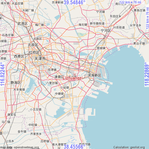
Lizhuangzi GPS coordinates[2]
39° 0' 15.012" North, 117° 31' 32.016" East
| Map corner | latitude | longitude |
|---|---|---|
| Upper-left | 39.54846°, | 116.82244° |
| Center: | 39.00417°, | 117.52556° |
| Lower-right: | 38.45566°, | 118.22869° |
| Map W x H: | 121.5×121.5 km | = 75.5×75.5mi |
| max Lat: | 53.31946° ⇑17.3% North |
| Lizhuangzi: | 39.00417° |
| min Lat: | ⇓82.7% South 18.22056° |
| min Long | Lizhuangzi | max Long |
| 75.07348° | 117.52556° | 134.28917° |
| W 68.9%⇐ | ⇒31.1% E |
Elevation
Elevation of Lizhuangzi is 1 m = 3 ft, and this is 483.8 m = 1587 ft below average elevation for this country.
| Max E: |
5622 m = 18445 ft | 99.7% |
| Avg. | 484.8 m = 1591 ft | |
| Lizhuangzi | 1 m = 3 ft | |
Min E: |
-3 m = -10 ft | 0.3% |
See also: China elevation on elevation.city.
Geographical zone
Lizhuangzi is located in North temperate zone (between Tropic of Cancer and the Arctic Circle). Distance of this Northern Tropic circle is 1730.9 km =1075.5 mi to South.| Distance of | km | miles | from Lizhuangzi |
|---|---|---|---|
| North Pole | 5670.2 | 3523.3 | to North |
| Arctic Circle | 3064.3 | 1904.1 | to North |
| Tropic Cancer | 1730.9 | 1075.5 | to South |
| Equator | 4336.9 | 2694.8 | to South |


Nearby cities:
15 places around Lizhuangzi: (largest is in red/bold)
• Beizhakou
12.5 km =7.8 mi,  244°
244°
• Dongnigu
7.2 km =4.5 mi,  281°
281°
• Gegu
2.1 km =1.3 mi,  222°
222°
• Junliangcheng
9.6 km =6 mi,  314°
314°
• Shuangqiaohe
9.2 km =5.7 mi,  259°
259°
• Tanggu
10.7 km =6.6 mi,  79°
79°
• Weiwangzhuang
7.7 km =4.8 mi,  287°
287°
• Wuxia
3.9 km =2.4 mi,  336°
336°
• Xianshuigu
12.5 km =7.8 mi, 260°
• Xiaodongzhuang
11.4 km =7.1 mi,  303°
303°
• Xiaozhan
13.5 km =8.4 mi, 219°
• Xincheng
3.5 km =2.2 mi,  131°
131°
• Xinhe
9.2 km =5.7 mi,  64°
64°
• Yonghe
9 km =5.6 mi,  331°
331°
• Zhongxinqiao
4.8 km =3 mi,  38°
38°
Sources, notices
• [Note1] Compared only with cities in China existing in our database
• [Src1] Map data: © OpenStreetMap contributors (CC-BY-SA)
• [Src2] Other city data from geonames.org with taken over terms of usage.
• [Src3] Geographical zone / Annual Mean Temperature by Robert A. Rohde @ Wikipedia
