Dongnigu geodata
Dongnigu (Tianjin) is a populated place; located in China in Asia/Shanghai (GMT+8) time zone. With population of 4,447 people, there are 881 cities with bigger population in this country. Compared to other cities in China, 82.8% of cities are located further ↓South; 68.5% of cities are located further ←West and 98.9% of cities have higher elevation than Dongnigu. Note1


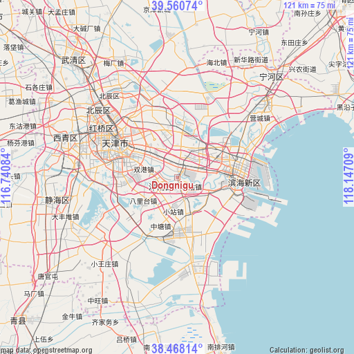
Dongnigu GPS coordinates[2]
39° 0' 59.58" North, 117° 26' 38.256" East
| Map corner | latitude | longitude |
|---|---|---|
| Upper-left | 39.56074°, | 116.74084° |
| Center: | 39.01655°, | 117.44396° |
| Lower-right: | 38.46814°, | 118.14709° |
| Map W x H: | 121.5×121.5 km | = 75.5×75.5mi |
| max Lat: | 53.31946° ⇑17.2% North |
| Dongnigu: | 39.01655° |
| min Lat: | ⇓82.8% South 18.22056° |
| min Long | Dongnigu | max Long |
| 75.07348° | 117.44396° | 134.28917° |
| W 68.5%⇐ | ⇒31.5% E |
Elevation
Elevation of Dongnigu is 3 m = 10 ft, and this is 481.8 m = 1581 ft below average elevation for this country.
| Max E: |
5622 m = 18445 ft | 98.9% |
| Avg. | 484.8 m = 1591 ft | |
| Dongnigu | 3 m = 10 ft | |
Min E: |
-3 m = -10 ft | 1.1% |
See also: China elevation on elevation.city.
Geographical zone
Dongnigu is located in North temperate zone (between Tropic of Cancer and the Arctic Circle). Distance of this Northern Tropic circle is 1732.3 km =1076.4 mi to South.| Distance of | km | miles | from Dongnigu |
|---|---|---|---|
| North Pole | 5668.8 | 3522.4 | to North |
| Arctic Circle | 3062.9 | 1903.2 | to North |
| Tropic Cancer | 1732.3 | 1076.4 | to South |
| Equator | 4338.2 | 2695.6 | to South |


Nearby cities:
15 places around Dongnigu: (largest is in red/bold)
• Beizhakou
8 km =5 mi,  212°
212°
• Gegu
6.3 km =3.9 mi,  117°
117°
• Junliangcheng
5.4 km =3.4 mi,  2°
2°
• Lizhuangzi
7.2 km =4.5 mi,  101°
101°
• Luotuofangzi
9.4 km =5.8 mi,  322°
322°
• Shuangqiaohe
3.7 km =2.3 mi, 213°
• Weiwangzhuang
1 km =0.6 mi,  343°
343°
• Wuxia
5.9 km =3.7 mi,  67°
67°
• Xianshuigu
6.3 km =3.9 mi,  236°
236°
• Xiaodongzhuang
5.5 km =3.4 mi,  333°
333°
• Xincheng
10.4 km =6.5 mi,  111°
111°
• Xinzhuang
8.7 km =5.4 mi,  276°
276°
• Yaoliuqiao
10.8 km =6.7 mi, 329°
• Yonghe
7.1 km =4.4 mi,  22°
22°
• Zhongxinqiao
10.4 km =6.5 mi,  76°
76°
Sources, notices
• [Note1] Compared only with cities in China existing in our database
• [Src1] Map data: © OpenStreetMap contributors (CC-BY-SA)
• [Src2] Other city data from geonames.org with taken over terms of usage.
• [Src3] Geographical zone / Annual Mean Temperature by Robert A. Rohde @ Wikipedia
