Lejian geodata
Lejian (Guizhou) is a seat of a fourth-order administrative division; located in China in Asia/Shanghai (GMT+8) time zone. In our database, there are 1268 cities with bigger population. Compared to other cities in China, 70.5% of cities are located further ↑North; 82.6% of cities are located further →East and 86.5% of cities have lower elevation than Lejian. Note1


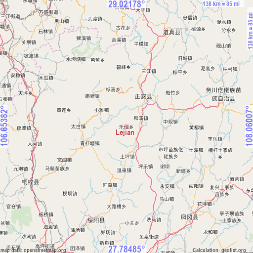
Lejian GPS coordinates[2]
28° 24' 18.432" North, 107° 21' 24.984" East
| Map corner | latitude | longitude |
|---|---|---|
| Upper-left | 29.02178°, | 106.65382° |
| Center: | 28.40512°, | 107.35694° |
| Lower-right: | 27.78485°, | 108.06007° |
| Map W x H: | 137.5×137.5 km | = 85.4×85.4mi |
| max Lat: | 53.31946° ⇑70.5% North |
| Lejian: | 28.40512° |
| min Lat: | ⇓29.5% South 18.22056° |
| min Long | Lejian | max Long |
| 75.07348° | 107.35694° | 134.28917° |
| W 17.4%⇐ | ⇒82.6% E |
Elevation
Elevation of Lejian is 1079 m = 3540 ft, and this is 594.2 m = 1949 ft above average elevation for this country.
| Max E: |
5622 m = 18445 ft | 13.5% |
| Lejian | 1079 m 3540 ft | |
| Avg. | 484.8 m = 1591 ft | |
Min E: |
-3 m = -10 ft | 86.5% |
See also: China elevation on elevation.city.
Geographical zone
Lejian is located in North temperate zone (between Tropic of Cancer and the Arctic Circle). Distance of this Northern Tropic circle is 552.4 km =343.2 mi to South.| Distance of | km | miles | from Lejian |
|---|---|---|---|
| North Pole | 6848.7 | 4255.6 | to North |
| Arctic Circle | 4242.8 | 2636.4 | to North |
| Tropic Cancer | 552.4 | 343.2 | to South |
| Equator | 3158.4 | 1962.5 | to South |


Nearby cities:
15 places around Lejian: (largest is in red/bold)
• Anchang
28.1 km =17.5 mi,  13°
13°
• Fengyi
18.4 km =11.4 mi,  25°
25°
• Gelin
22.5 km =14 mi,  44°
44°
• Hexi
9.4 km =5.8 mi,  52°
52°
• Jianping
18.1 km =11.2 mi, 46°
• Liudu
17.9 km =11.1 mi,  125°
125°
• Miaotang
25.1 km =15.6 mi,  312°
312°
• Pingle
23.8 km =14.8 mi,  154°
154°
• Ruixi
18.5 km =11.5 mi,  358°
358°
• Shiping
27.8 km =17.3 mi,  120°
120°
• Taibai
26.4 km =16.4 mi,  270°
270°
• Tuping
15.6 km =9.7 mi,  178°
178°
• Wenquan
22.6 km =14 mi, 182°
• Xiaoya
16.5 km =10.3 mi,  304°
304°
• Zhongguan
24 km =14.9 mi,  83°
83°
Sources, notices
• [Note1] Compared only with cities in China existing in our database
• [Src1] Map data: © OpenStreetMap contributors (CC-BY-SA)
• [Src2] Other city data from geonames.org with taken over terms of usage.
• [Src3] Geographical zone / Annual Mean Temperature by Robert A. Rohde @ Wikipedia
