Jincun geodata
Jincun (Henan) is a seat of a fourth-order administrative division; located in China in Asia/Shanghai (GMT+8) time zone. In our database, there are 1268 cities with bigger population. Compared to other cities in China, 69.8% of cities are located further ↓South; 61.4% of cities are located further →East and 79.5% of cities have lower elevation than Jincun. Note1


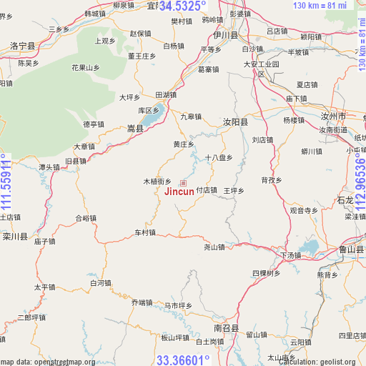
Jincun GPS coordinates[2]
33° 57' 4.5" North, 112° 15' 44.028" East
| Map corner | latitude | longitude |
|---|---|---|
| Upper-left | 34.5325°, | 111.55911° |
| Center: | 33.95125°, | 112.26223° |
| Lower-right: | 33.36601°, | 112.96536° |
| Map W x H: | 129.7×129.7 km | = 80.6×80.6mi |
| max Lat: | 53.31946° ⇑30.2% North |
| Jincun: | 33.95125° |
| min Lat: | ⇓69.8% South 18.22056° |
| min Long | Jincun | max Long |
| 75.07348° | 112.26223° | 134.28917° |
| W 38.6%⇐ | ⇒61.4% E |
Elevation
Elevation of Jincun is 671 m = 2201 ft, and this is 186.2 m = 611 ft above average elevation for this country.
| Max E: |
5622 m = 18445 ft | 20.5% |
| Jincun | 671 m 2201 ft | |
| Avg. | 484.8 m = 1591 ft | |
Min E: |
-3 m = -10 ft | 79.5% |
See also: China elevation on elevation.city.
Geographical zone
Jincun is located in North temperate zone (between Tropic of Cancer and the Arctic Circle). Distance of this Northern Tropic circle is 1169.1 km =726.4 mi to South.| Distance of | km | miles | from Jincun |
|---|---|---|---|
| North Pole | 6232 | 3872.4 | to North |
| Arctic Circle | 3626.1 | 2253.2 | to North |
| Tropic Cancer | 1169.1 | 726.4 | to South |
| Equator | 3775 | 2345.7 | to South |


Nearby cities:
15 places around Jincun: (largest is in red/bold)
• Beizi
31.5 km =19.6 mi,  87°
87°
• Cangtou
49.6 km =30.8 mi,  99°
99°
• Checun
21.8 km =13.5 mi,  217°
217°
• Cuizhuang
48.3 km =30 mi,  165°
165°
• Fudian
9 km =5.6 mi, 103°
• Guanyinsi
44 km =27.3 mi, 102°
• Muzhijie
9 km =5.6 mi,  277°
277°
• Ruyang Chengguanzhen
28.6 km =17.8 mi,  39°
39°
• Sikeshu
43.5 km =27 mi,  136°
136°
• Song Xian Chengguanzhen
26.3 km =16.3 mi,  320°
320°
• Wangping
18.3 km =11.4 mi, 98°
• Wawu
37.4 km =23.2 mi, 100°
• Xiatang
46.4 km =28.8 mi,  123°
123°
• Yaoshan
24.8 km =15.4 mi,  153°
153°
• Zhaocun
29.7 km =18.5 mi, 137°
Sources, notices
• [Note1] Compared only with cities in China existing in our database
• [Src1] Map data: © OpenStreetMap contributors (CC-BY-SA)
• [Src2] Other city data from geonames.org with taken over terms of usage.
• [Src3] Geographical zone / Annual Mean Temperature by Robert A. Rohde @ Wikipedia
