Hengxianhe geodata
Hengxianhe (Shaanxi) is a seat of a fourth-order administrative division; located in China in Asia/Shanghai (GMT+8) time zone. In our database, there are 1268 cities with bigger population. Compared to other cities in China, 67.5% of cities are located further ↓South; 86.6% of cities are located further →East and 79.6% of cities have lower elevation than Hengxianhe. Note1


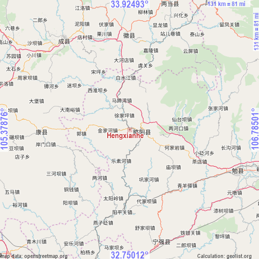
Hengxianhe GPS coordinates[2]
33° 20' 22.236" North, 106° 4' 54.768" East
| Map corner | latitude | longitude |
|---|---|---|
| Upper-left | 33.92493°, | 105.37876° |
| Center: | 33.33951°, | 106.08188° |
| Lower-right: | 32.75012°, | 106.78501° |
| Map W x H: | 130.6×130.6 km | = 81.2×81.2mi |
| max Lat: | 53.31946° ⇑32.5% North |
| Hengxianhe: | 33.33951° |
| min Lat: | ⇓67.5% South 18.22056° |
| min Long | Hengxianhe | max Long |
| 75.07348° | 106.08188° | 134.28917° |
| W 13.4%⇐ | ⇒86.6% E |
Elevation
Elevation of Hengxianhe is 674 m = 2211 ft, and this is 189.2 m = 621 ft above average elevation for this country.
| Max E: |
5622 m = 18445 ft | 20.4% |
| Hengxianhe | 674 m 2211 ft | |
| Avg. | 484.8 m = 1591 ft | |
Min E: |
-3 m = -10 ft | 79.6% |
See also: China elevation on elevation.city.
Geographical zone
Hengxianhe is located in North temperate zone (between Tropic of Cancer and the Arctic Circle). Distance of this Northern Tropic circle is 1101.1 km =684.2 mi to South.| Distance of | km | miles | from Hengxianhe |
|---|---|---|---|
| North Pole | 6300.1 | 3914.7 | to North |
| Arctic Circle | 3694.2 | 2295.5 | to North |
| Tropic Cancer | 1101.1 | 684.2 | to South |
| Equator | 3707 | 2303.4 | to South |


Nearby cities:
15 places around Hengxianhe: (largest is in red/bold)
• Baiquesi
13.1 km =8.1 mi,  181°
181°
• Baishigou
11.1 km =6.9 mi,  69°
69°
• Guozhen
23.9 km =14.9 mi,  266°
266°
• Hejiayan
24.4 km =15.2 mi,  111°
111°
• Jieguanting
17.7 km =11 mi,  116°
116°
• Jinjiahe
10.7 km =6.6 mi, 270°
• Jiuzhongjin
24.1 km =15 mi,  31°
31°
• Lesuhe
15.7 km =9.8 mi,  195°
195°
• Lianghekou
24.9 km =15.5 mi,  87°
87°
• Lüeyang Chengguanzhen
6.8 km =4.2 mi,  96°
96°
• Matiwan
15.7 km =9.8 mi,  348°
348°
• Shijiayuan
9 km =5.6 mi,  232°
232°
• Xujiaping
7.7 km =4.8 mi,  342°
342°
• Yudongzi
22.4 km =13.9 mi, 94°
• Zengjiahe
24.7 km =15.3 mi,  170°
170°
Sources, notices
• [Note1] Compared only with cities in China existing in our database
• [Src1] Map data: © OpenStreetMap contributors (CC-BY-SA)
• [Src2] Other city data from geonames.org with taken over terms of usage.
• [Src3] Geographical zone / Annual Mean Temperature by Robert A. Rohde @ Wikipedia
