Duruan geodata
Duruan (Guangdong) is a seat of a fourth-order administrative division; located in China in Asia/Shanghai (GMT+8) time zone. In our database, there are 1268 cities with bigger population. Compared to other cities in China, 96% of cities are located further ↑North; 57.5% of cities are located further →East and 84.3% of cities have higher elevation than Duruan. Note1


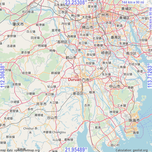
Duruan GPS coordinates[2]
22° 36' 19.872" North, 113° 0' 34.2" East
| Map corner | latitude | longitude |
|---|---|---|
| Upper-left | 23.25308°, | 112.30638° |
| Center: | 22.60552°, | 113.0095° |
| Lower-right: | 21.95489°, | 113.71263° |
| Map W x H: | 144.3×144.3 km | = 89.7×89.7mi |
| max Lat: | 53.31946° ⇑96% North |
| Duruan: | 22.60552° |
| min Lat: | ⇓4% South 18.22056° |
| min Long | Duruan | max Long |
| 75.07348° | 113.0095° | 134.28917° |
| W 42.5%⇐ | ⇒57.5% E |
Elevation
Elevation of Duruan is 17 m = 56 ft, and this is 467.8 m = 1535 ft below average elevation for this country.
| Max E: |
5622 m = 18445 ft | 84.3% |
| Avg. | 484.8 m = 1591 ft | |
| Duruan | 17 m = 56 ft | |
Min E: |
-3 m = -10 ft | 15.7% |
See also: China elevation on elevation.city.
Geographical zone
Duruan is located in North Torrid zone (between Equator and Tropic of Cancer). Distance of this Northern Tropic circle is 92.4 km =57.4 mi to North.| Distance of | km | miles | from Duruan |
|---|---|---|---|
| North Pole | 7493.6 | 4656.3 | to North |
| Arctic Circle | 4887.7 | 3037.1 | to North |
| Tropic Cancer | 92.4 | 57.4 | to North |
| Equator | 2513.5 | 1561.8 | to South |


Nearby cities:
15 places around Duruan: (largest is in red/bold)
• Baisha
7.3 km =4.5 mi,  116°
116°
• Beijie
9.4 km =5.8 mi,  87°
87°
• Canghou
6.1 km =3.8 mi,  105°
105°
• Chaolian
10.8 km =6.7 mi,  73°
73°
• Huanshi
6 km =3.7 mi,  102°
102°
• Huicheng
9.1 km =5.7 mi,  166°
166°
• Jianghai
11.7 km =7.3 mi, 106°
• Jiangmen
8 km =5 mi, 108°
• Jiangnan
9.1 km =5.7 mi, 100°
• Jiaobei
9.6 km =6 mi, 95°
• Jiaotou
9.2 km =5.7 mi, 111°
• Lianjiang
7.1 km =4.4 mi, 103°
• Lile
10.8 km =6.7 mi,  135°
135°
• Tangxia
8.8 km =5.5 mi,  15°
15°
• Tidong
8.4 km =5.2 mi, 97°
Sources, notices
• [Note1] Compared only with cities in China existing in our database
• [Src1] Map data: © OpenStreetMap contributors (CC-BY-SA)
• [Src2] Other city data from geonames.org with taken over terms of usage.
• [Src3] Geographical zone / Annual Mean Temperature by Robert A. Rohde @ Wikipedia
