Dongtazhuang geodata
Dongtazhuang (Tianjin) is a populated place; located in China in Asia/Shanghai (GMT+8) time zone. With population of 1,440 people, there are 1102 cities with bigger population in this country. Compared to other cities in China, 86% of cities are located further ↓South; 68% of cities are located further ←West and 95.9% of cities have higher elevation than Dongtazhuang. Note1


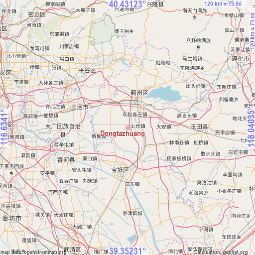
Dongtazhuang GPS coordinates[2]
39° 53' 38.004" North, 117° 20' 13.992" East
| Map corner | latitude | longitude |
|---|---|---|
| Upper-left | 40.43123°, | 116.6341° |
| Center: | 39.89389°, | 117.33722° |
| Lower-right: | 39.35231°, | 118.04035° |
| Map W x H: | 120×120 km | = 74.6×74.6mi |
| max Lat: | 53.31946° ⇑14% North |
| Dongtazhuang: | 39.89389° |
| min Lat: | ⇓86% South 18.22056° |
| min Long | Dongtazhuang | max Long |
| 75.07348° | 117.33722° | 134.28917° |
| W 68%⇐ | ⇒32% E |
Elevation
Elevation of Dongtazhuang is 6 m = 20 ft, and this is 478.8 m = 1571 ft below average elevation for this country.
| Max E: |
5622 m = 18445 ft | 95.9% |
| Avg. | 484.8 m = 1591 ft | |
| Dongtazhuang | 6 m = 20 ft | |
Min E: |
-3 m = -10 ft | 4.1% |
See also: China elevation on elevation.city.
Geographical zone
Dongtazhuang is located in North temperate zone (between Tropic of Cancer and the Arctic Circle). Distance of this Northern Tropic circle is 1829.9 km =1137 mi to South.| Distance of | km | miles | from Dongtazhuang |
|---|---|---|---|
| North Pole | 5571.3 | 3461.8 | to North |
| Arctic Circle | 2965.4 | 1842.6 | to North |
| Tropic Cancer | 1829.9 | 1137 | to South |
| Equator | 4435.8 | 2756.3 | to South |


Nearby cities:
15 places around Dongtazhuang: (largest is in red/bold)
• Bangjun
12.5 km =7.8 mi,  329°
329°
• Dabao’anzhen
11.9 km =7.4 mi,  87°
87°
• Dayanggezhuang
11.1 km =6.9 mi,  138°
138°
• Dongshigu
1.8 km =1.1 mi,  199°
199°
• Dongzhaogezhuang
6.7 km =4.2 mi,  24°
24°
• Dong’erying
8.6 km =5.3 mi, 325°
• Liuzikou
2.7 km =1.7 mi,  162°
162°
• Lizhuangzi
10.1 km =6.3 mi,  346°
346°
• Sanchakou
12.3 km =7.6 mi,  187°
187°
• Shangcang
4.4 km =2.7 mi,  81°
81°
• Touying
12.8 km =8 mi,  307°
307°
• Xiacang
13.7 km =8.5 mi,  150°
150°
• Yangjinzhuang
5.3 km =3.3 mi,  100°
100°
• Yinliu
11.1 km =6.9 mi,  27°
27°
• Youguzhuang
7.9 km =4.9 mi,  279°
279°
Sources, notices
• [Note1] Compared only with cities in China existing in our database
• [Src1] Map data: © OpenStreetMap contributors (CC-BY-SA)
• [Src2] Other city data from geonames.org with taken over terms of usage.
• [Src3] Geographical zone / Annual Mean Temperature by Robert A. Rohde @ Wikipedia
