Donghuishe geodata
Donghuishe (Hebei) is a seat of a fourth-order administrative division; located in China in Asia/Shanghai (GMT+8) time zone. In our database, there are 1268 cities with bigger population. Compared to other cities in China, 81.3% of cities are located further ↓South; 50.8% of cities are located further →East and 50.3% of cities have higher elevation than Donghuishe. Note1


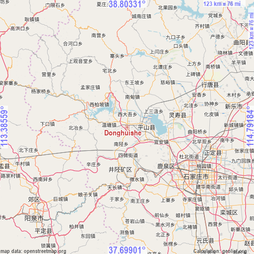
Donghuishe GPS coordinates[2]
38° 15' 11.736" North, 114° 5' 19.356" East
| Map corner | latitude | longitude |
|---|---|---|
| Upper-left | 38.80331°, | 113.38559° |
| Center: | 38.25326°, | 114.08871° |
| Lower-right: | 37.69901°, | 114.79184° |
| Map W x H: | 122.8×122.8 km | = 76.3×76.3mi |
| max Lat: | 53.31946° ⇑18.7% North |
| Donghuishe: | 38.25326° |
| min Lat: | ⇓81.3% South 18.22056° |
| min Long | Donghuishe | max Long |
| 75.07348° | 114.08871° | 134.28917° |
| W 49.2%⇐ | ⇒50.8% E |
Elevation
Elevation of Donghuishe is 162 m = 531 ft, and this is 322.8 m = 1059 ft below average elevation for this country.
| Max E: |
5622 m = 18445 ft | 50.3% |
| Avg. | 484.8 m = 1591 ft | |
| Donghuishe | 162 m = 531 ft | |
Min E: |
-3 m = -10 ft | 49.7% |
See also: China elevation on elevation.city.
Geographical zone
Donghuishe is located in North temperate zone (between Tropic of Cancer and the Arctic Circle). Distance of this Northern Tropic circle is 1647.4 km =1023.6 mi to South.| Distance of | km | miles | from Donghuishe |
|---|---|---|---|
| North Pole | 5753.7 | 3575.2 | to North |
| Arctic Circle | 3147.8 | 1956 | to North |
| Tropic Cancer | 1647.4 | 1023.6 | to South |
| Equator | 4253.4 | 2642.9 | to South |


Nearby cities:
15 places around Donghuishe: (largest is in red/bold)
• Gangnan
9.6 km =6 mi,  322°
322°
• Huangbizhuang
19.6 km =12.2 mi,  90°
90°
• Jiazhuang
17.7 km =11 mi,  194°
194°
• Lianghe
10.9 km =6.8 mi,  33°
33°
• Nandian
15.2 km =9.4 mi,  12°
12°
• Nanxing
8.5 km =5.3 mi,  201°
201°
• Niucheng
18.7 km =11.6 mi,  83°
83°
• Shangsanji
14.5 km =9 mi,  57°
57°
• Sujiazhuang
18.8 km =11.7 mi,  336°
336°
• Sunzhuang
12.1 km =7.5 mi,  159°
159°
• Tashang
18.6 km =11.6 mi, 32°
• Weizhou
17.2 km =10.7 mi, 161°
• Xiaozuo
16.2 km =10.1 mi, 202°
• Xidawu
6.1 km =3.8 mi,  4°
4°
• Yi’an
17.7 km =11 mi,  113°
113°
Sources, notices
• [Note1] Compared only with cities in China existing in our database
• [Src1] Map data: © OpenStreetMap contributors (CC-BY-SA)
• [Src2] Other city data from geonames.org with taken over terms of usage.
• [Src3] Geographical zone / Annual Mean Temperature by Robert A. Rohde @ Wikipedia
