Dingzhai geodata
Dingzhai (Hubei) is a seat of a fourth-order administrative division; located in China in Asia/Shanghai (GMT+8) time zone. In our database, there are 1268 cities with bigger population. Compared to other cities in China, 58.6% of cities are located further ↑North; 76.1% of cities are located further →East and 81.4% of cities have lower elevation than Dingzhai. Note1


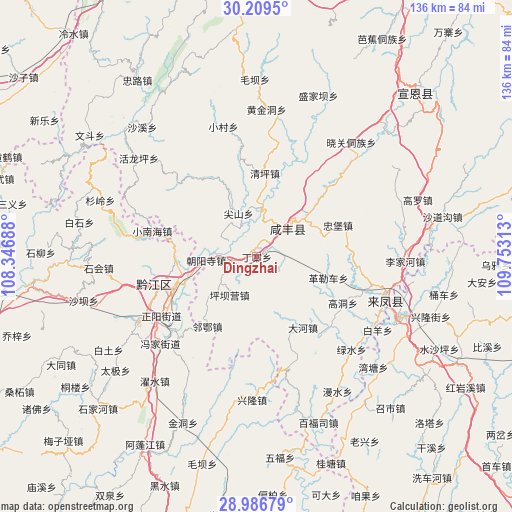
Dingzhai GPS coordinates[2]
29° 36' 0" North, 109° 3' 0" East
| Map corner | latitude | longitude |
|---|---|---|
| Upper-left | 30.2095°, | 108.34688° |
| Center: | 29.6°, | 109.05° |
| Lower-right: | 28.98679°, | 109.75313° |
| Map W x H: | 136×136 km | = 84.5×84.5mi |
| max Lat: | 53.31946° ⇑58.6% North |
| Dingzhai: | 29.6° |
| min Lat: | ⇓41.4% South 18.22056° |
| min Long | Dingzhai | max Long |
| 75.07348° | 109.05° | 134.28917° |
| W 23.9%⇐ | ⇒76.1% E |
Elevation
Elevation of Dingzhai is 763 m = 2503 ft, and this is 278.2 m = 913 ft above average elevation for this country.
| Max E: |
5622 m = 18445 ft | 18.6% |
| Dingzhai | 763 m 2503 ft | |
| Avg. | 484.8 m = 1591 ft | |
Min E: |
-3 m = -10 ft | 81.4% |
See also: China elevation on elevation.city.
Geographical zone
Dingzhai is located in North temperate zone (between Tropic of Cancer and the Arctic Circle). Distance of this Northern Tropic circle is 685.3 km =425.8 mi to South.| Distance of | km | miles | from Dingzhai |
|---|---|---|---|
| North Pole | 6715.9 | 4173.1 | to North |
| Arctic Circle | 4110 | 2553.8 | to North |
| Tropic Cancer | 685.3 | 425.8 | to South |
| Equator | 3291.2 | 2045.1 | to South |


Nearby cities:
15 places around Dingzhai: (largest is in red/bold)
• Chaoyangsi
13.7 km =8.5 mi,  266°
266°
• Chengdong
26.8 km =16.7 mi,  251°
251°
• Chengnan
27.4 km =17 mi, 251°
• Dahe
22.4 km =13.9 mi,  146°
146°
• Gaoleshan
12.6 km =7.8 mi,  46°
46°
• Geleche
19.7 km =12.2 mi,  106°
106°
• Hujiagou
26.6 km =16.5 mi,  96°
96°
• Jiamachi
12.5 km =7.8 mi,  215°
215°
• Jianshan
12.5 km =7.8 mi,  336°
336°
• Jiusi
27.1 km =16.8 mi,  132°
132°
• Mingxing
23.1 km =14.4 mi,  67°
67°
• Qianjiang
27.6 km =17.1 mi, 254°
• Qingshuitang
22.1 km =13.7 mi,  4°
4°
• Zhongtang
21.7 km =13.5 mi, 273°
• Zhoubai
23.3 km =14.5 mi, 250°
Sources, notices
• [Note1] Compared only with cities in China existing in our database
• [Src1] Map data: © OpenStreetMap contributors (CC-BY-SA)
• [Src2] Other city data from geonames.org with taken over terms of usage.
• [Src3] Geographical zone / Annual Mean Temperature by Robert A. Rohde @ Wikipedia
