Caomiaozi geodata
Caomiaozi (Shandong) is a seat of a fourth-order administrative division; located in China in Asia/Shanghai (GMT+8) time zone. In our database, there are 1268 cities with bigger population. Compared to other cities in China, 79.8% of cities are located further ↓South; 91.4% of cities are located further ←West and 65.3% of cities have higher elevation than Caomiaozi. Note1


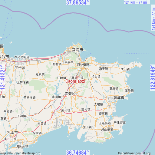
Caomiaozi GPS coordinates[2]
37° 18' 29.412" North, 122° 6' 58.788" East
| Map corner | latitude | longitude |
|---|---|---|
| Upper-left | 37.86534°, | 121.41321° |
| Center: | 37.30817°, | 122.11633° |
| Lower-right: | 36.74684°, | 122.81946° |
| Map W x H: | 124.4×124.4 km | = 77.3×77.3mi |
| max Lat: | 53.31946° ⇑20.2% North |
| Caomiaozi: | 37.30817° |
| min Lat: | ⇓79.8% South 18.22056° |
| min Long | Caomiaozi | max Long |
| 75.07348° | 122.11633° | 134.28917° |
| W 91.4%⇐ | ⇒8.6% E |
Elevation
Elevation of Caomiaozi is 71 m = 233 ft, and this is 413.8 m = 1358 ft below average elevation for this country.
| Max E: |
5622 m = 18445 ft | 65.3% |
| Avg. | 484.8 m = 1591 ft | |
| Caomiaozi | 71 m = 233 ft | |
Min E: |
-3 m = -10 ft | 34.7% |
See also: China elevation on elevation.city.
Geographical zone
Caomiaozi is located in North temperate zone (between Tropic of Cancer and the Arctic Circle). Distance of this Northern Tropic circle is 1542.4 km =958.4 mi to South.| Distance of | km | miles | from Caomiaozi |
|---|---|---|---|
| North Pole | 5858.8 | 3640.5 | to North |
| Arctic Circle | 3252.9 | 2021.3 | to North |
| Tropic Cancer | 1542.4 | 958.4 | to South |
| Equator | 4148.3 | 2577.6 | to South |


Nearby cities:
15 places around Caomiaozi: (largest is in red/bold)
• Dashuipo
17.9 km =11.1 mi,  139°
139°
• Fenglin
12.6 km =7.8 mi,  22°
22°
• Gushan
15.5 km =9.6 mi,  44°
44°
• Heshan
5.1 km =3.2 mi,  238°
238°
• Huancuilou
21.4 km =13.3 mi,  359°
359°
• Huangguan
15.3 km =9.5 mi,  10°
10°
• Qiaotou
14.6 km =9.1 mi,  85°
85°
• Tianfu
7.5 km =4.7 mi,  228°
228°
• Wangtuan
12.5 km =7.8 mi,  269°
269°
• Wendengying
10.7 km =6.6 mi,  187°
187°
• Wenquan
8.6 km =5.3 mi,  29°
29°
• Xiyuan
11.9 km =7.4 mi, 13°
• Yangting
14.8 km =9.2 mi,  330°
330°
• Yinzi
20.2 km =12.6 mi,  120°
120°
• Zhangcun
21 km =13 mi,  339°
339°
Sources, notices
• [Note1] Compared only with cities in China existing in our database
• [Src1] Map data: © OpenStreetMap contributors (CC-BY-SA)
• [Src2] Other city data from geonames.org with taken over terms of usage.
• [Src3] Geographical zone / Annual Mean Temperature by Robert A. Rohde @ Wikipedia
