Dashuipo geodata
Dashuipo (Shandong) is a seat of a fourth-order administrative division; located in China in Asia/Shanghai (GMT+8) time zone. In our database, there are 1268 cities with bigger population. Compared to other cities in China, 79.6% of cities are located further ↓South; 91.6% of cities are located further ←West and 68.7% of cities have higher elevation than Dashuipo. Note1


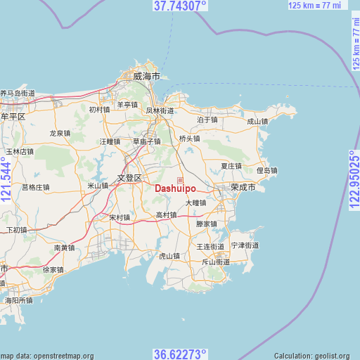
Dashuipo GPS coordinates[2]
37° 11' 5.928" North, 122° 14' 49.632" East
| Map corner | latitude | longitude |
|---|---|---|
| Upper-left | 37.74307°, | 121.544° |
| Center: | 37.18498°, | 122.24712° |
| Lower-right: | 36.62273°, | 122.95025° |
| Map W x H: | 124.6×124.6 km | = 77.4×77.4mi |
| max Lat: | 53.31946° ⇑20.4% North |
| Dashuipo: | 37.18498° |
| min Lat: | ⇓79.6% South 18.22056° |
| min Long | Dashuipo | max Long |
| 75.07348° | 122.24712° | 134.28917° |
| W 91.6%⇐ | ⇒8.4% E |
Elevation
Elevation of Dashuipo is 57 m = 187 ft, and this is 427.8 m = 1404 ft below average elevation for this country.
| Max E: |
5622 m = 18445 ft | 68.7% |
| Avg. | 484.8 m = 1591 ft | |
| Dashuipo | 57 m = 187 ft | |
Min E: |
-3 m = -10 ft | 31.3% |
See also: China elevation on elevation.city.
Geographical zone
Dashuipo is located in North temperate zone (between Tropic of Cancer and the Arctic Circle). Distance of this Northern Tropic circle is 1528.7 km =949.9 mi to South.| Distance of | km | miles | from Dashuipo |
|---|---|---|---|
| North Pole | 5872.5 | 3649 | to North |
| Arctic Circle | 3266.6 | 2029.8 | to North |
| Tropic Cancer | 1528.7 | 949.9 | to South |
| Equator | 4134.6 | 2569.1 | to South |


Nearby cities:
15 places around Dashuipo: (largest is in red/bold)
• Caomiaozi
17.9 km =11.1 mi,  319°
319°
• Datuan
9.3 km =5.8 mi,  144°
144°
• Gaocun
12.2 km =7.6 mi,  203°
203°
• Heshan
19.4 km =12.1 mi,  304°
304°
• Houjia
23 km =14.3 mi,  217°
217°
• Qiaotou
15.2 km =9.4 mi,  11°
11°
• Shangzhuang
21 km =13 mi,  170°
170°
• Tengjia
16.5 km =10.3 mi,  147°
147°
• Tianfu
19.3 km =12 mi, 296°
• Wendengying
13.4 km =8.3 mi,  283°
283°
• Wenquan
22.5 km =14 mi,  340°
340°
• Xiazhuang
18.9 km =11.7 mi,  73°
73°
• Yatou
17.2 km =10.7 mi,  100°
100°
• Yaxi
12.9 km =8 mi,  54°
54°
• Yinzi
6.7 km =4.2 mi,  60°
60°
Sources, notices
• [Note1] Compared only with cities in China existing in our database
• [Src1] Map data: © OpenStreetMap contributors (CC-BY-SA)
• [Src2] Other city data from geonames.org with taken over terms of usage.
• [Src3] Geographical zone / Annual Mean Temperature by Robert A. Rohde @ Wikipedia
