Caigongzhuang geodata
Caigongzhuang (Tianjin) is a seat of a fourth-order administrative division; located in China in Asia/Shanghai (GMT+8) time zone. In our database, there are 1268 cities with bigger population. Compared to other cities in China, 82.3% of cities are located further ↓South; 66.3% of cities are located further ←West and 97.2% of cities have higher elevation than Caigongzhuang. Note1


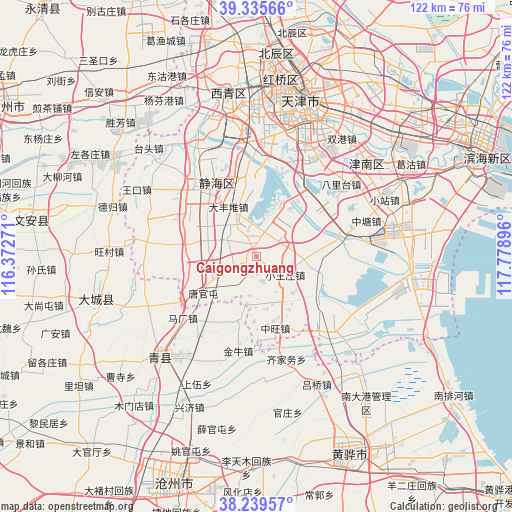
Caigongzhuang GPS coordinates[2]
38° 47' 22.992" North, 117° 4' 32.988" East
| Map corner | latitude | longitude |
|---|---|---|
| Upper-left | 39.33566°, | 116.37271° |
| Center: | 38.78972°, | 117.07583° |
| Lower-right: | 38.23957°, | 117.77896° |
| Map W x H: | 121.9×121.9 km | = 75.7×75.7mi |
| max Lat: | 53.31946° ⇑17.7% North |
| Caigongzhuang: | 38.78972° |
| min Lat: | ⇓82.3% South 18.22056° |
| min Long | Caigongzhuang | max Long |
| 75.07348° | 117.07583° | 134.28917° |
| W 66.3%⇐ | ⇒33.7% E |
Elevation
Elevation of Caigongzhuang is 5 m = 16 ft, and this is 479.8 m = 1574 ft below average elevation for this country.
| Max E: |
5622 m = 18445 ft | 97.2% |
| Avg. | 484.8 m = 1591 ft | |
| Caigongzhuang | 5 m = 16 ft | |
Min E: |
-3 m = -10 ft | 2.8% |
See also: China elevation on elevation.city.
Geographical zone
Caigongzhuang is located in North temperate zone (between Tropic of Cancer and the Arctic Circle). Distance of this Northern Tropic circle is 1707.1 km =1060.7 mi to South.| Distance of | km | miles | from Caigongzhuang |
|---|---|---|---|
| North Pole | 5694 | 3538.1 | to North |
| Arctic Circle | 3088.2 | 1918.9 | to North |
| Tropic Cancer | 1707.1 | 1060.7 | to South |
| Equator | 4313 | 2680 | to South |


Nearby cities:
15 places around Caigongzhuang: (largest is in red/bold)
• Balitai
25.1 km =15.6 mi,  47°
47°
• Chenguantun
15.1 km =9.4 mi,  282°
282°
• Dafengdui
13.1 km =8.1 mi,  331°
331°
• Daqiuzhuang
5.4 km =3.4 mi,  338°
338°
• Dasi
29 km =18 mi,  28°
28°
• Duliu
30.3 km =18.8 mi, 331°
• Jinghai
20.6 km =12.8 mi,  321°
321°
• Liangwangzhuang
28.2 km =17.5 mi, 339°
• Shuangtang
17.4 km =10.8 mi,  301°
301°
• Tuanpo
13.7 km =8.5 mi, 26°
• Wangwenzhuang
19.6 km =12.2 mi,  58°
58°
• Xiaowangzhuang
8 km =5 mi,  122°
122°
• Xizhaizhuang
6.8 km =4.2 mi,  251°
251°
• Yangchengzhuang
17.1 km =10.6 mi,  352°
352°
• Zhangjiawo
29.8 km =18.5 mi, 354°
Sources, notices
• [Note1] Compared only with cities in China existing in our database
• [Src1] Map data: © OpenStreetMap contributors (CC-BY-SA)
• [Src2] Other city data from geonames.org with taken over terms of usage.
• [Src3] Geographical zone / Annual Mean Temperature by Robert A. Rohde @ Wikipedia
