Dasi geodata
Dasi (Tianjin) is a seat of a fourth-order administrative division; located in China in Asia/Shanghai (GMT+8) time zone. With population of 1,167 people, there are 1141 cities with bigger population in this country. Compared to other cities in China, 82.8% of cities are located further ↓South; 67.4% of cities are located further ←West and 95.9% of cities have higher elevation than Dasi. Note1


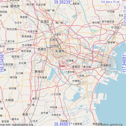
Dasi GPS coordinates[2]
39° 1' 5.556" North, 117° 14' 15.648" East
| Map corner | latitude | longitude |
|---|---|---|
| Upper-left | 39.56239°, | 116.53456° |
| Center: | 39.01821°, | 117.23768° |
| Lower-right: | 38.46981°, | 117.94081° |
| Map W x H: | 121.5×121.5 km | = 75.5×75.5mi |
| max Lat: | 53.31946° ⇑17.2% North |
| Dasi: | 39.01821° |
| min Lat: | ⇓82.8% South 18.22056° |
| min Long | Dasi | max Long |
| 75.07348° | 117.23768° | 134.28917° |
| W 67.4%⇐ | ⇒32.6% E |
Elevation
Elevation of Dasi is 6 m = 20 ft, and this is 478.8 m = 1571 ft below average elevation for this country.
| Max E: |
5622 m = 18445 ft | 95.9% |
| Avg. | 484.8 m = 1591 ft | |
| Dasi | 6 m = 20 ft | |
Min E: |
-3 m = -10 ft | 4.1% |
See also: China elevation on elevation.city.
Geographical zone
Dasi is located in North temperate zone (between Tropic of Cancer and the Arctic Circle). Distance of this Northern Tropic circle is 1732.5 km =1076.5 mi to South.| Distance of | km | miles | from Dasi |
|---|---|---|---|
| North Pole | 5668.6 | 3522.3 | to North |
| Arctic Circle | 3062.8 | 1903.1 | to North |
| Tropic Cancer | 1732.5 | 1076.5 | to South |
| Equator | 4338.4 | 2695.8 | to South |


Nearby cities:
15 places around Dasi: (largest is in red/bold)
• Chentangzhuang
5.7 km =3.5 mi,  18°
18°
• Cuijiamatou
8.3 km =5.2 mi,  40°
40°
• Darenzhuang
2.6 km =1.6 mi,  28°
28°
• Donghai
3.9 km =2.4 mi,  12°
12°
• Fuminlu
7.9 km =4.9 mi, 8°
• Guajiasi
8.2 km =5.1 mi,  353°
353°
• Jianshan
7.8 km =4.8 mi, 351°
• Liqizhuang
8.7 km =5.4 mi,  311°
311°
• Liulin
5.6 km =3.5 mi, 25°
• Shuanggang
6.9 km =4.3 mi,  65°
65°
• Taoyuan
8.7 km =5.4 mi, 351°
• Tianta
8.6 km =5.3 mi,  325°
325°
• Tiyu Zhongxin
8.1 km =5 mi, 312°
• Youyilu
7.3 km =4.5 mi, 332°
• Yuexiulu
8.2 km =5.1 mi, 351°
Sources, notices
• [Note1] Compared only with cities in China existing in our database
• [Src1] Map data: © OpenStreetMap contributors (CC-BY-SA)
• [Src2] Other city data from geonames.org with taken over terms of usage.
• [Src3] Geographical zone / Annual Mean Temperature by Robert A. Rohde @ Wikipedia
