Badaogu geodata
Badaogu (Tianjin) is a populated place; located in China in Asia/Shanghai (GMT+8) time zone. With population of 2,226 people, there are 1009 cities with bigger population in this country. Compared to other cities in China, 84.5% of cities are located further ↓South; 67.9% of cities are located further ←West and 99.7% of cities have higher elevation than Badaogu. Note1


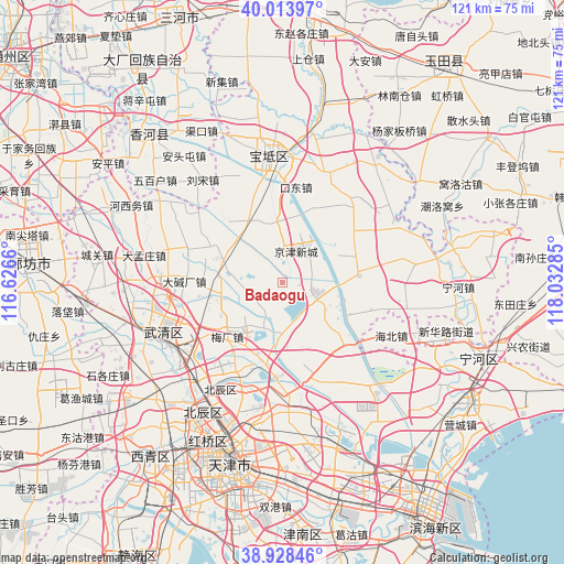
Badaogu GPS coordinates[2]
39° 28' 23.988" North, 117° 19' 46.992" East
| Map corner | latitude | longitude |
|---|---|---|
| Upper-left | 40.01397°, | 116.6266° |
| Center: | 39.47333°, | 117.32972° |
| Lower-right: | 38.92846°, | 118.03285° |
| Map W x H: | 120.7×120.7 km | = 75×75mi |
| max Lat: | 53.31946° ⇑15.5% North |
| Badaogu: | 39.47333° |
| min Lat: | ⇓84.5% South 18.22056° |
| min Long | Badaogu | max Long |
| 75.07348° | 117.32972° | 134.28917° |
| W 67.9%⇐ | ⇒32.1% E |
Elevation
Elevation of Badaogu is 1 m = 3 ft, and this is 483.8 m = 1587 ft below average elevation for this country.
| Max E: |
5622 m = 18445 ft | 99.7% |
| Avg. | 484.8 m = 1591 ft | |
| Badaogu | 1 m = 3 ft | |
Min E: |
-3 m = -10 ft | 0.3% |
See also: China elevation on elevation.city.
Geographical zone
Badaogu is located in North temperate zone (between Tropic of Cancer and the Arctic Circle). Distance of this Northern Tropic circle is 1783.1 km =1108 mi to South.| Distance of | km | miles | from Badaogu |
|---|---|---|---|
| North Pole | 5618 | 3490.9 | to North |
| Arctic Circle | 3012.2 | 1871.7 | to North |
| Tropic Cancer | 1783.1 | 1108 | to South |
| Equator | 4389 | 2727.2 | to South |


Nearby cities:
15 places around Badaogu: (largest is in red/bold)
• Beilizigu
11.8 km =7.3 mi,  80°
80°
• Chabaihu
15.6 km =9.7 mi,  266°
266°
• Cuihuangkou
14.1 km =8.8 mi,  294°
294°
• Dabaizhuang
5.4 km =3.4 mi,  126°
126°
• Dahuangpu
5.7 km =3.5 mi,  231°
231°
• Dakoutun
15 km =9.3 mi,  324°
324°
• Datangzhuang
12.2 km =7.6 mi, 132°
• Erwangzhuang
9.3 km =5.8 mi,  167°
167°
• Heilangkou
16.7 km =10.4 mi,  21°
21°
• Huangzhuang
15.8 km =9.8 mi,  86°
86°
• Meichang
17.5 km =10.9 mi, 227°
• Niujiapai
6.4 km =4 mi,  327°
327°
• Shimianzhuang
16.4 km =10.2 mi,  244°
244°
• Sigaozhuang
6.8 km =4.2 mi,  264°
264°
• Zhongdeng
13.2 km =8.2 mi,  8°
8°
Sources, notices
• [Note1] Compared only with cities in China existing in our database
• [Src1] Map data: © OpenStreetMap contributors (CC-BY-SA)
• [Src2] Other city data from geonames.org with taken over terms of usage.
• [Src3] Geographical zone / Annual Mean Temperature by Robert A. Rohde @ Wikipedia
