Qingyang geodata
Qingyang (Chongqing) is a seat of a fourth-order administrative division; located in China in Asia/Shanghai (GMT+8) time zone. In our database, there are 1268 cities with bigger population. Compared to other cities in China, 59.4% of cities are located further ↑North; 83.1% of cities are located further →East and 81.1% of cities have lower elevation than Qingyang. Note1


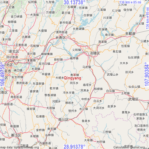
Qingyang GPS coordinates[2]
29° 31' 38.748" North, 107° 12' 2.556" East
| Map corner | latitude | longitude |
|---|---|---|
| Upper-left | 30.13738°, | 106.49759° |
| Center: | 29.52743°, | 107.20071° |
| Lower-right: | 28.91378°, | 107.90384° |
| Map W x H: | 136.1×136.1 km | = 84.6×84.6mi |
| max Lat: | 53.31946° ⇑59.4% North |
| Qingyang: | 29.52743° |
| min Lat: | ⇓40.6% South 18.22056° |
| min Long | Qingyang | max Long |
| 75.07348° | 107.20071° | 134.28917° |
| W 16.9%⇐ | ⇒83.1% E |
Elevation
Elevation of Qingyang is 747 m = 2451 ft, and this is 262.2 m = 860 ft above average elevation for this country.
| Max E: |
5622 m = 18445 ft | 18.9% |
| Qingyang | 747 m 2451 ft | |
| Avg. | 484.8 m = 1591 ft | |
Min E: |
-3 m = -10 ft | 81.1% |
See also: China elevation on elevation.city.
Geographical zone
Qingyang is located in North temperate zone (between Tropic of Cancer and the Arctic Circle). Distance of this Northern Tropic circle is 677.2 km =420.8 mi to South.| Distance of | km | miles | from Qingyang |
|---|---|---|---|
| North Pole | 6723.9 | 4178 | to North |
| Arctic Circle | 4118 | 2558.8 | to North |
| Tropic Cancer | 677.2 | 420.8 | to South |
| Equator | 3283.1 | 2040 | to South |


Nearby cities:
15 places around Qingyang: (largest is in red/bold)
• Baozi
9.2 km =5.7 mi,  344°
344°
• Fenglai
16.9 km =10.5 mi,  146°
146°
• Huimin
10.3 km =6.4 mi,  17°
17°
• Jubao
13.2 km =8.2 mi,  176°
176°
• Lengshuiguan
17.1 km =10.6 mi,  198°
198°
• Lianghui
15.4 km =9.6 mi,  321°
321°
• Linshi
15.5 km =9.6 mi,  357°
357°
• Longtan
13.1 km =8.1 mi,  226°
226°
• Mawu
13.1 km =8.1 mi,  56°
56°
• Miaoya
14.6 km =9.1 mi,  128°
128°
• Mingjia
13.9 km =8.6 mi,  259°
259°
• Taihe
11 km =6.8 mi,  91°
91°
• Tongle
7.4 km =4.6 mi, 182°
• Yajiang
18.6 km =11.6 mi,  115°
115°
• Zili
17.1 km =10.6 mi,  75°
75°
Sources, notices
• [Note1] Compared only with cities in China existing in our database
• [Src1] Map data: © OpenStreetMap contributors (CC-BY-SA)
• [Src2] Other city data from geonames.org with taken over terms of usage.
• [Src3] Geographical zone / Annual Mean Temperature by Robert A. Rohde @ Wikipedia
