Lingkou geodata
Lingkou (Hainan) is a seat of a fourth-order administrative division; located in China in Asia/Shanghai (GMT+8) time zone. In our database, there are 1268 cities with bigger population. Compared to other cities in China, 99.3% of cities are located further ↑North; 70% of cities are located further →East and 56.3% of cities have higher elevation than Lingkou. Note1


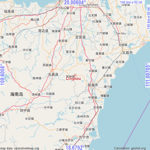
Lingkou GPS coordinates[2]
19° 20' 38.292" North, 110° 18' 14.112" East
| Map corner | latitude | longitude |
|---|---|---|
| Upper-left | 20.00604°, | 109.6008° |
| Center: | 19.34397°, | 110.30392° |
| Lower-right: | 18.6792°, | 111.00705° |
| Map W x H: | 147.5×147.5 km | = 91.7×91.7mi |
| max Lat: | 53.31946° ⇑99.3% North |
| Lingkou: | 19.34397° |
| min Lat: | ⇓0.7% South 18.22056° |
| min Long | Lingkou | max Long |
| 75.07348° | 110.30392° | 134.28917° |
| W 30%⇐ | ⇒70% E |
Elevation
Elevation of Lingkou is 122 m = 400 ft, and this is 362.8 m = 1190 ft below average elevation for this country.
| Max E: |
5622 m = 18445 ft | 56.3% |
| Avg. | 484.8 m = 1591 ft | |
| Lingkou | 122 m = 400 ft | |
Min E: |
-3 m = -10 ft | 43.7% |
See also: China elevation on elevation.city.
Geographical zone
Lingkou is located in North Torrid zone (between Equator and Tropic of Cancer). Distance of this Northern Tropic circle is 455.1 km =282.8 mi to North.| Distance of | km | miles | from Lingkou |
|---|---|---|---|
| North Pole | 7856.2 | 4881.6 | to North |
| Arctic Circle | 5250.3 | 3262.4 | to North |
| Tropic Cancer | 455.1 | 282.8 | to North |
| Equator | 2150.8 | 1336.4 | to South |


Nearby cities:
15 places around Lingkou: (largest is in red/bold)
• Dalu
17.7 km =11 mi,  73°
73°
• Fuwen
23.6 km =14.7 mi,  347°
347°
• Hanlin
4.9 km =3 mi,  256°
256°
• Huangzhu
20.6 km =12.8 mi,  43°
43°
• Leiming
23.8 km =14.8 mi,  4°
4°
• Longhe
10.7 km =6.6 mi,  293°
293°
• Longjiang
21.9 km =13.6 mi,  175°
175°
• Longmen
11.2 km =7 mi,  11°
11°
• Poxin
23.6 km =14.7 mi, 258°
• Qionghai
20.3 km =12.6 mi,  123°
123°
• Shibi
19.9 km =12.4 mi, 180°
• Tayang
21.9 km =13.6 mi,  105°
105°
• Tuncheng
21.7 km =13.5 mi,  275°
275°
• Wanquan
15.3 km =9.5 mi,  136°
136°
• Xinxing
22.9 km =14.2 mi,  324°
324°
Sources, notices
• [Note1] Compared only with cities in China existing in our database
• [Src1] Map data: © OpenStreetMap contributors (CC-BY-SA)
• [Src2] Other city data from geonames.org with taken over terms of usage.
• [Src3] Geographical zone / Annual Mean Temperature by Robert A. Rohde @ Wikipedia
